The 4 p.m. Storm That Arrives Like Clockwork
Anyone who has spent summers in Florida, the Rocky Mountain foothills, or the humid Southeast knows the pattern: mornings are clear and warm, afternoons build dramatic cumulus clouds, and by 3 or 4 p.m. thunderstorms are rumbling across the landscape with near-daily regularity. The storms clear by evening, the air smells clean, and the next morning the cycle begins again.
This daily summer storm pattern is one of the most reliable and least mysterious phenomena in meteorology — reliable because it’s driven by the same solar heating cycle that repeats every single day, least mysterious because the physics behind it are elegant and straightforward once understood. It is also completely different in character from the organized severe weather of spring, which is driven by large-scale weather systems, fronts, and the jet stream. Summer’s afternoon convective storms are driven almost entirely by the sun heating the surface — local, predictable, and remarkably consistent.
The Daily Heating Cycle: The Engine of Summer Storms
The daily cycle of summer convective storms begins at sunrise and plays out the same way every clear summer day, driven by the transfer of solar energy from the ground surface to the atmosphere above it.
As the sun rises and solar radiation reaches the surface, the ground begins absorbing energy and warming. The air immediately above the surface warms by conduction — direct contact with the warm ground — and by absorbing infrared radiation emitted upward from the heated surface. This warming creates a layer of warm, buoyant air near the ground that is less dense than the cooler air above it.
When this surface air becomes sufficiently buoyant — warmer than the air above it by enough to overcome the resistance of the overlying atmosphere — it begins rising in columns called thermals. Thermals are the invisible rising columns of air that hawks and glider pilots seek out, and in summer they develop from virtually every patch of warm ground by mid-morning.
As a thermal rises and cools — air cools as it expands with decreasing pressure at altitude — it eventually reaches the lifting condensation level, the altitude at which its temperature has dropped to its dew point and water vapor begins condensing into cloud droplets. This is the altitude at which cumulus clouds form, producing the flat-based, rounded-top clouds that appear over warm land surfaces on summer mornings. As covered in the spring cloud formation piece, the flat bases of cumulus clouds are all at roughly the same altitude because the lifting condensation level is consistent across the area.
Through the morning and early afternoon, increasing solar heating makes the thermals stronger and the atmosphere above the lifting condensation level less stable. Cumulus clouds that were small and well-separated in the morning grow larger and taller through the afternoon, their tops billowing upward as updrafts strengthen. By early afternoon in unstable atmospheric conditions, these growing cumulus clouds begin producing brief showers. By mid-afternoon, the most vigorous cells have grown into full thunderstorms with lightning, heavy rain, and sometimes small hail.
Why Afternoon, Not Morning
The concentration of summer convective storms in the afternoon rather than the morning is a direct reflection of solar heating accumulation. Convection requires surface temperatures significantly warmer than the air aloft — the greater this temperature contrast, the stronger and more explosive the convective development.
In the morning, surface temperatures are at their daily minimum — the ground has been cooling all night through radiative heat loss and has not yet had time to warm significantly. Even on a day that will eventually reach 92°F, the morning surface temperature might be 65°F — insufficient to generate strong thermals or significant cumulative instability.
Through the morning hours, the surface warms steadily as solar radiation accumulates. The overlying atmosphere warms more slowly because it receives less direct solar heating — it heats primarily from the surface up, not from the sun directly. By early afternoon, the surface-to-atmosphere temperature contrast has reached its daily maximum, producing the most intense thermals, the most rapid cloud development, and the greatest convective instability. This maximum instability window — typically between 1 p.m. and 5 p.m. — is when thunderstorms are most likely to develop from solar heating alone.
By late afternoon and evening, solar heating begins to decline as the sun lowers toward the horizon. Surface temperatures reach their maximum around 3 to 4 p.m. and then begin falling. As the surface-to-atmosphere temperature contrast decreases, convective driving weakens. Many afternoon thunderstorms dissipate by evening as the instability that supported them diminishes — though some storms, particularly those that have organized into larger systems, can persist into the night.
Why Some Places Get Daily Storms and Others Don’t
The daily summer storm pattern is most pronounced in specific regions and largely absent in others — a geographic distribution that reflects the interplay of moisture, terrain, and atmospheric stability.
Florida is the thunderstorm capital of North America, averaging more than 100 thunderstorm days per year in its interior. The reason is geometric: Florida is a peninsula surrounded on three sides by warm water. Sea breeze circulations advance from both the Gulf Coast to the west and the Atlantic Coast to the east simultaneously each afternoon. When these two sea breezes converge in Florida’s interior, they produce a band of forced lifting that is almost guaranteed to trigger thunderstorm development on any day with adequate moisture — which in Florida’s summer is nearly every day. The convergence of sea breezes, not just the solar heating, explains why Florida’s storm frequency exceeds that of other humid regions at similar latitudes.
The Rocky Mountain foothills experience remarkably reliable afternoon storms because terrain forcing supplements solar heating as a lift mechanism. As surface air is heated during the morning, it begins flowing up mountain slopes — a process called anabatic flow — concentrating moisture and rising air along terrain features that focus convective development. By early afternoon, this forced terrain lifting combines with the instability generated by surface heating to produce thunderstorms that develop over the mountains with extraordinary regularity in summer. Anyone who has hiked in Colorado knows the rule: be off exposed ridges by noon, because the afternoon storm will arrive.
The humid Southeast — Georgia, Alabama, Mississippi, Arkansas — experiences frequent afternoon storms because high dew points in summer provide abundant moisture fuel for convection. The combination of high surface temperatures and high moisture content produces extreme instability that makes thunderstorm development likely on any afternoon without strong atmospheric capping.
The Southwest deserts — Arizona, New Mexico, Nevada — experience a dramatically different summer pattern. Dry conditions through late spring and early summer suppress convection despite intense surface heating, because the atmosphere is too dry to support deep convective development. The arrival of the North American Monsoon in July and August — a seasonal wind shift that draws moisture northward from the Gulf of California and Gulf of Mexico — transforms the desert storm pattern almost overnight. Before the monsoon, the desert receives essentially no summer rain. During the monsoon, afternoon storms develop with a frequency and intensity that rivals the humid Southeast.
The Pacific Coast is the major exception to summer afternoon storm patterns in the United States. Marine influence from the cool Pacific Ocean stabilizes the lower atmosphere along the coast, suppressing convective development. The marine layer — a shallow layer of cool, moist air that flows inland from the cool ocean — keeps temperatures near the coast dramatically lower than inland areas and prevents the surface heating that drives convection. San Francisco rarely experiences a thunderstorm in any month, let alone in summer. The storm pattern that defines summer from Florida to Kansas is essentially absent within a hundred miles of the Pacific Coast.
The Difference Between Summer Convective Storms and Spring Severe Weather
Understanding summer’s daily convective storm pattern requires appreciating how fundamentally different it is from the organized severe weather of spring — a distinction that matters practically for both safety and forecasting.
Spring’s severe weather is driven by large-scale atmospheric dynamics: cold fronts, drylines, the jet stream, and the extreme wind shear that produces supercells and tornadoes. These ingredients produce organized, long-lived, and often violent storms that affect large areas simultaneously and are forecastable days in advance.
Summer’s afternoon convective storms are driven primarily by local surface heating with minimal large-scale organization. They are shorter-lived, smaller in horizontal extent, less likely to produce tornadoes, and far less predictable in terms of exactly where they will develop. The afternoon thunderstorm that drenches your backyard while the neighborhood a mile away stays dry is expressing the same mesoscale variability covered in the 5/16 science piece — convection triggered by local surface temperature variations, small terrain features, and the chance positions of sea breeze boundaries and outflow from earlier storms.
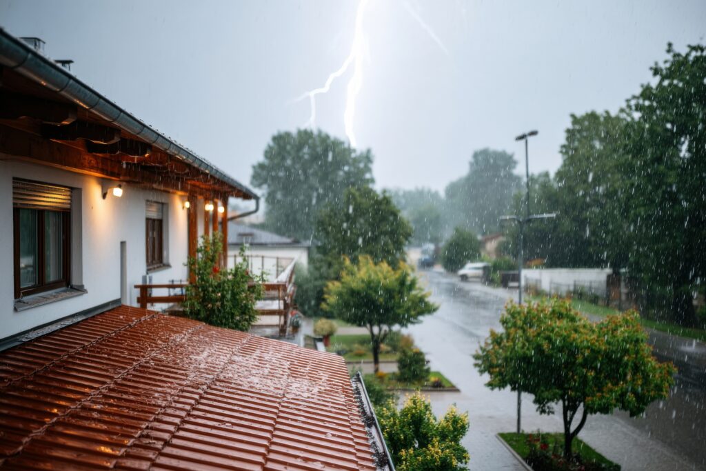
This doesn’t mean summer convective storms are harmless. They produce dangerous lightning, locally intense rainfall capable of flash flooding, and occasional damaging wind gusts from strong downdrafts and microbursts. A summer afternoon storm that develops directly overhead can produce conditions as dangerous as any severe thunderstorm warning — the difference is that it developed quickly, locally, and with less warning lead time than an organized spring severe weather system.
Reading the Summer Sky
The daily heating cycle makes summer thunderstorm development visible in a way that spring’s system-driven severe weather often isn’t. Watching how cumulus clouds evolve through a summer morning and early afternoon provides real-time information about whether afternoon storms are likely.
Cumulus clouds that remain small and well-separated through late morning — not growing significantly taller through 11 a.m. — indicate a stable atmosphere that is capping convective development. Storms are unlikely on such a day unless a triggering boundary arrives.
Cumulus clouds that begin growing rapidly in the late morning — towering noticeably taller by 11 a.m., with crisp, cauliflower-textured tops — indicate an atmosphere with little or no cap on convective development. Afternoon storms are likely, and the earlier this rapid growth begins, the more time the storms have to develop into significant cells.
The summer sky is communicating constantly about what the afternoon will bring. It rewards anyone who pays attention to the clouds during the morning hours rather than waiting for the afternoon storm to announce itself with thunder.