A Storm That Broke the Intensity Scale Itself
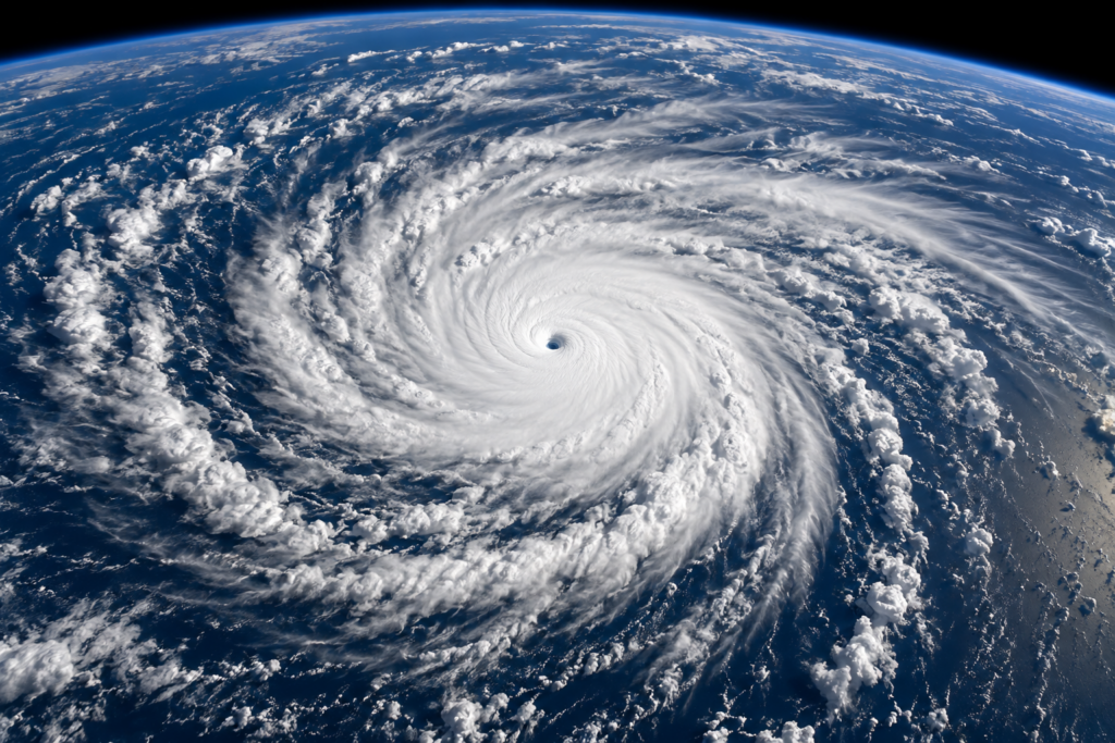
In October 2005, Hurricane Wilma achieved a central pressure of 882 millibars, the lowest barometric pressure ever recorded in an Atlantic hurricane, making it, by that specific measure, the most intense Atlantic tropical cyclone on record. Wilma capped off the historically active 2005 Atlantic hurricane season—the same season that produced Katrina and Rita—with a display of rapid intensification and extreme intensity that pushed the boundaries of what forecasters believed possible for an Atlantic storm.
An Almost Unbelievable Rate of Intensification
Wilma’s transformation from a tropical storm into one of the most intense hurricanes ever recorded happened with startling speed. In roughly 24 hours, Wilma’s central pressure dropped by more than 100 millibars, and its maximum sustained winds increased from 70 mph to 175 mph—a rate of intensification so extreme it remains one of the fastest strengthening rates ever documented in the Atlantic basin.
This rapid intensification occurred as Wilma moved over the exceptionally warm waters of the northwestern Caribbean, an area that had already fueled several of the 2005 season’s other historically powerful storms. The combination of near-record ocean heat content and favorable atmospheric conditions allowed Wilma to develop an unusually small, tightly wound eye—at one point measured at just two nautical miles across, among the smallest hurricane eyes ever recorded, which contributed directly to the storm’s extraordinarily low central pressure.
A Storm That Weakened Before Its Most Destructive Landfall
Unlike many hurricanes that cause their most severe damage at peak intensity, Wilma had weakened somewhat by the time it made its two significant landfalls—first in the Yucatán Peninsula of Mexico, where it stalled for an extended period causing prolonged, severe impacts on the resort areas of Cancún and the surrounding coast, and later in southwest Florida as a still-powerful Category 3 hurricane.
Wilma’s Florida landfall proved that a storm doesn’t need to be at its historical peak intensity to cause extensive, widespread damage. The storm’s large wind field brought hurricane-force winds across a wide swath of South Florida, including areas like Miami-Dade and Broward counties, which experienced significant structural damage and widespread, prolonged power outages despite the storm having weakened from its earlier Category 5 peak.
Widespread Power Outages Across South Florida
Wilma’s Florida impact became notable for the sheer scale and duration of the power outages it caused, affecting more than 6 million people across South Florida, some for several weeks. This extended outage duration, occurring across a region with a large population accustomed to relatively infrequent and typically shorter hurricane-related power disruptions, created significant secondary hardship, including heat-related health concerns during the extended recovery period and considerable economic disruption across the affected region.
The scale of these outages prompted subsequent scrutiny of the region’s power grid resilience and contributed to utility infrastructure hardening investments in the years that followed, as Florida utilities worked to reduce the vulnerability that Wilma’s widespread, extended outages had exposed.
A Fitting Capstone to a Historic Season
Wilma’s extreme intensity arrived as the twenty-second named storm of the 2005 Atlantic hurricane season, a season so active that the National Hurricane Center exhausted the standard hurricane name list for the first time in recorded history and had to begin using Greek alphabet letters for subsequent storms. This context matters for understanding Wilma’s place in hurricane history: it wasn’t simply an isolated extreme event, but rather the most intense expression of an entire season’s worth of exceptionally favorable hurricane development conditions across the Atlantic basin.
Why Wilma’s Record Still Matters Two Decades Later
Wilma’s record-low pressure remains the benchmark for Atlantic hurricane intensity nearly twenty years later, and the storm continues to serve as an important reference point in hurricane research specifically focused on rapid intensification—a phenomenon that has become an increasing focus of forecasting improvement efforts, given how dramatically a storm’s threat level can change within a very short window when conditions favor this kind of rapid strengthening.
The storm’s Florida impact also reinforced a lesson relevant well beyond Wilma itself: a hurricane’s peak historical intensity and its actual landfall impact can differ significantly, and even a weakening storm can produce widespread, serious consequences, particularly when it affects a large, densely populated metropolitan area like South Florida.
A Record That Represents the Atmosphere’s Extreme Potential
Hurricane Wilma stands as a stark demonstration of just how intense an Atlantic hurricane can become when every contributing atmospheric and oceanic factor aligns favorably. Its record intensity, remarkably rapid strengthening, and its subsequent widespread Florida impact together make it one of the most significant storms of the historically active 2005 season, and a lasting benchmark against which Atlantic hurricane intensity continues to be measured.