The Most Intense Landfalling Hurricane of the 20th Century
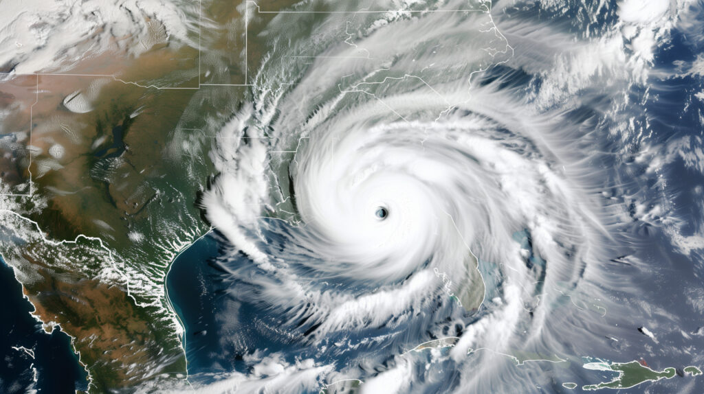
On the night of August 17-18, 1969, Hurricane Camille made landfall near the mouth of the Mississippi River on the Gulf Coast of Mississippi with maximum sustained winds estimated at 190 mph and a central pressure of 900 millibars — making it the most intense landfalling hurricane ever recorded in the continental United States up to that point and one of only three Category 5 storms to make landfall on the U.S. mainland in the 20th century.
The storm surge that accompanied Camille reached 24 feet along portions of the Mississippi Gulf Coast — the highest storm surge ever recorded in the United States at that time. The surge arrived with the speed and force of a moving wall of water that swept inland for miles, obliterating structures that had survived previous storms and killing people who had sought shelter in buildings they believed were adequate.
Camille killed 259 people in total — 143 from the direct landfall impacts, and a further 113 in Virginia and West Virginia from catastrophic flooding as the storm’s remnants crossed the Appalachians and produced extraordinary rainfall on already-saturated terrain. It remains, alongside the Galveston Hurricane of 1900 and the Labor Day Hurricane of 1935, as one of the defining events in American hurricane history — not just for what it did to the Gulf Coast but for what it changed about how meteorologists understand, communicate, and prepare for the upper end of hurricane intensity.
The Storm’s Development
Camille’s development was rapid and extraordinary even by the standards of intense Atlantic tropical cyclones. It entered the Gulf of Mexico as a tropical storm, intensified to hurricane strength over the warm Gulf waters, and then underwent explosive deepening that carried it from a strong Category 2 to a Category 5 storm in approximately 24 hours before landfall.
The Gulf of Mexico in August 1969 was primed for exactly this kind of rapid intensification: sea surface temperatures well above 80°F, a moist and unstable atmosphere, low wind shear, and no significant dry air or atmospheric disturbances to disrupt the storm’s circulation. Camille found in the Gulf an environment as favorable for intensification as any tropical cyclone could encounter, and it responded by deepening to near the theoretical maximum intensity that the warm waters could support.
The National Hurricane Center tracked the storm with the tools available in 1969 — a combination of aircraft reconnaissance, ship reports, and early satellite imagery that was far less sophisticated than modern systems but sufficient to establish the storm’s track and general intensity. Mandatory evacuation orders were issued for low-lying coastal areas, and most residents did evacuate. But not all.
The Party That Became a Tragedy
The most haunting story from Hurricane Camille’s landfall involves a gathering of approximately 25 people in the Richelieu Manor Apartments in Pass Christian, Mississippi — a three-story building that its occupants apparently believed was substantial enough to survive the storm. Some accounts describe the gathering as a “hurricane party” — people who had deliberately chosen to stay and experience the storm rather than evacuate. Other accounts suggest some of the residents had simply not received the evacuation order or believed they were in an adequate structure.
The Richelieu Manor Apartments were directly in the path of Camille’s storm surge. When the surge arrived in the early morning hours of August 18, it was not the gradual rise of floodwater that residents might have imagined and prepared for — it was a rapid, violent inundation that overwhelmed the building and swept it from its foundation. Of the approximately 25 people in the building, only one survived. The others were killed by the surge or by the collapse of the structure.
The Richelieu Manor story became, in the years following Camille, one of the most repeated cautionary tales in hurricane safety communication — a concrete illustration of what storm surge could do to a seemingly substantial building, and of the fatal consequences of believing that a structure’s size or construction quality offered protection from a 24-foot surge. It entered the cultural vocabulary of hurricane preparedness and is still referenced in National Hurricane Center communications about storm surge danger.
The Storm Surge That Redefined Understanding
Before Camille, the primary meteorological focus in hurricane forecasting and public communication was wind speed. The Saffir-Simpson scale — developed in the early 1970s partly in response to Camille — categorized hurricanes by wind speed, and wind speed dominated both the scientific and public understanding of hurricane danger.
Camille’s storm surge demonstrated that wind speed, while important, was an incomplete measure of a hurricane’s destructive potential. The 24-foot surge that accompanied Camille — driven by the storm’s extreme winds, its large physical size, the shallow continental shelf of the Gulf Coast, and the specific geometry of the coastline — killed far more people and caused far more structural damage than the wind itself. Buildings that might have survived Category 5 wind loads were swept away by 24 feet of moving ocean water.
The recognition that storm surge was the primary killer in most major hurricane events — a fact that the Galveston Hurricane of 1900 had demonstrated at catastrophic scale but that had not been fully incorporated into the hurricane warning and communication framework — accelerated substantially after Camille. The development of the SLOSH storm surge model, which now forms the basis of the National Hurricane Center’s storm surge products, was driven partly by the need to better predict and communicate the surge threat that Camille had made undeniable.
The distinction between Saffir-Simpson wind categories and storm surge potential — a distinction that the hurricane myths piece addressed and that the NHC now communicates explicitly through separate storm surge watches and warnings — has its roots partly in the post-Camille recognition that wind category alone was insufficient to convey the surge hazard.
Virginia and the Camille Floods
Camille’s death toll was not limited to the Gulf Coast. As the storm’s remnants crossed the Appalachians and stalled over Virginia and West Virginia on August 19-20, 1969, they produced rainfall totals that reached 27 inches in portions of Nelson County, Virginia — one of the highest rainfall totals ever recorded in the eastern United States from a tropical system.
The mountainous terrain of the Blue Ridge concentrated this extraordinary rainfall into stream and river valleys, producing flash flooding of catastrophic intensity. Nelson County, Virginia was the epicenter: approximately 113 people were killed in a county with a population of 11,000 — a per-capita death toll that exceeded the Gulf Coast’s direct landfall casualties. Entire communities were swept away, bridges were destroyed, and roads were obliterated, leaving survivors isolated for days.
The Nelson County floods were, at the time, almost unknown outside the region — the national media’s attention was fixed on the Gulf Coast landfall, and the Appalachian flooding occurred two days later, separated from the famous storm by geography and time. The flood’s full toll emerged slowly, as the isolation of communities prevented rapid accounting of casualties.
The Camille floods in Virginia contributed to the development of improved flash flood warning systems in the Appalachians, where the combination of steep terrain and intense tropical rainfall creates recurring flash flood potential that had been recognized but inadequately addressed before 1969.
What Camille Changed
Hurricane Camille’s legacy in meteorology and emergency management is substantial and specific.
It accelerated the development of quantitative storm surge prediction through the SLOSH model and contributed to the eventual creation of separate storm surge watches and warnings — the most important single change in hurricane warning communication in the past 50 years.
It drove improvements in coastal building codes that attempted to translate Camille’s structural lessons into construction standards. The communities that rebuilt after Camille did so with requirements for elevated construction, reinforced connections between structures and foundations, and impact-resistant glazing that reflected the storm’s demonstrated destructive potential.
It established in the public consciousness — through the Richelieu Manor story and through the physical evidence of structures swept completely from their foundations — the concept that no building in a coastal storm surge zone was safe from a major hurricane, regardless of its construction quality. This concept, which emergency managers continue to communicate with varying success, is the foundation of the evacuation culture that has developed along the Gulf Coast since 1969.
And it provided the scientific community with an extreme data point — a storm that reached what may be near the physical maximum intensity possible in the Gulf of Mexico — that has informed theoretical work on hurricane intensity limits and the relationship between sea surface temperature, atmospheric conditions, and potential intensity that remains active in hurricane research today.
The Category 5 Experience
Only three Category 5 hurricanes have made landfall on the U.S. mainland: the Labor Day Hurricane of 1935, Hurricane Camille in 1969, and Hurricane Andrew in 1992 (at its Florida landfall). Each of these storms produced impacts that exceeded the expectations of residents, emergency managers, and in some cases meteorologists — not because the forecasts were wrong but because the human experience of what a Category 5 hurricane actually does to the built environment at landfall is beyond what can be conveyed in numbers and categories alone.
The Saffir-Simpson scale’s Category 5 description — “catastrophic damage will occur” — is accurate but abstract. Camille made it concrete: a 24-foot surge that swept buildings from their foundations, 190 mph winds that stripped structures to their slabs, and 113 people killed by rainfall 800 miles from where the eye made landfall. The storm’s physical record was eventually exceeded by Hurricane Andrew in 1992 and approached by others, but its place in the history of American hurricane understanding was established in the early morning hours of August 18, 1969, and has not diminished in the more than half century since.