Why One Creates Deadly Black Ice While the Other Just Makes Roads Slippery
When winter weather forecasts mention “wintry mix” or “frozen precipitation,” many people assume all ice falling from the sky is basically the same. But freezing rain and sleet are fundamentally different types of precipitation that form through different processes and create vastly different hazards. Confusing the two can lead to dangerous miscalculations about driving conditions, power outage risks, and safety precautions. Understanding how these two forms of ice develop—and why freezing rain is far more dangerous—helps you respond appropriately when winter weather threatens.
How Sleet Forms
Sleet, also called ice pellets, forms through a specific atmospheric temperature profile:
Snow falls from clouds where temperatures are below freezing in the upper atmosphere.
The snow passes through a warm layer where air temperature is above 32°F. In this layer, snowflakes completely melt into liquid raindrops.
Raindrops then fall through a deep, cold layer near the surface where temperatures are well below freezing. This cold layer must be thick enough and cold enough that raindrops have time to refreeze into solid ice pellets before reaching the ground.
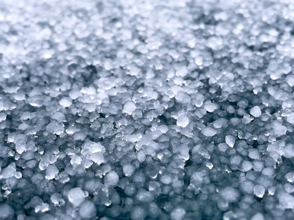
Ice pellets hit the ground as small, hard balls of ice—sleet. They bounce off surfaces with a distinctive sound, accumulate like hail, and create a crunchy layer on the ground.
The key requirement for sleet is that deep, cold surface layer. Raindrops need several thousand feet of below-freezing air to completely refreeze. Without sufficient cold air depth, you get freezing rain instead.
How Freezing Rain Forms
Freezing rain requires a different atmospheric setup:
Snow falls from clouds in the upper atmosphere where temperatures are below freezing.
Snow passes through a warm layer and completely melts into liquid raindrops, just like with sleet.
Raindrops fall through a shallow, cold layer at the surface. This layer is either too shallow or not cold enough—or both—to allow raindrops to refreeze into ice pellets.
Supercooled raindrops reach the ground still in liquid form despite being colder than 32°F. These droplets are supercooled—cooled below their normal freezing point while remaining liquid.
Upon contact with any surface—roads, trees, power lines, cars—the supercooled water instantly freezes into a smooth, clear coating of ice called glaze.
The critical difference is that shallow surface cold layer. With freezing rain, the cold air isn’t sufficient to refreeze the drops before they reach the ground.
Why You Can Hear the Difference
One of the easiest ways to distinguish sleet from freezing rain is by sound:
Sleet makes noise. Ice pellets bouncing off your car, windows, and roof create a distinctive pinging, tapping, or rattling sound. You can hear sleet accumulating.
Freezing rain is silent. Liquid droplets hitting surfaces make the same soft sound as regular rain. There’s no bouncing, no rattling—just the quiet patter of rain that’s freezing on contact.
If you hear precipitation bouncing and pinging, you’re experiencing sleet. If it sounds like rain but the temperature is at or below freezing, you’re likely dealing with the more dangerous freezing rain.
Comparing the Hazards
While both create winter travel problems, their dangers differ dramatically:
Sleet Hazards (Less Severe):
Roads become slippery as ice pellets accumulate, similar to driving on loose gravel or ball bearings. Traction is reduced but not completely eliminated.
Accumulation is visible. You can see the layer of ice pellets on roads, giving drivers visual warning of conditions.
Minimal weight accumulation on trees and power lines. Sleet pellets don’t stick to vertical surfaces effectively.
Easier to remove. Plows and salt can address sleet-covered roads relatively effectively.
Less structural damage. Buildings and vehicles aren’t significantly affected by accumulated sleet.
Freezing Rain Hazards (Severe):
Roads become skating rinks. The smooth glaze ice provides almost no traction. Black ice forms that’s nearly invisible.
No visual warning. Roads look wet, not icy, until you try to brake or turn and discover there’s no traction.
Catastrophic weight accumulation on trees and power lines. A quarter-inch of ice can add hundreds of pounds to tree branches and power lines, causing massive failures.
Extremely difficult to remove. Ice bonds to pavement strongly. Salt has limited effectiveness. Mechanical removal is challenging.
Structural damage is extensive. Roofs can collapse under ice weight. Power outages can last weeks as ice-damaged infrastructure requires complete rebuilding in some areas.
Multi-day or multi-week impacts. Ice storms can paralyze entire regions for extended periods.
Why Forecasters Emphasize the Difference
Meteorologists carefully distinguish between sleet and freezing rain in forecasts because the impacts differ so dramatically:
A forecast of “1 inch of sleet” means roads will be slippery and hazardous, requiring careful driving and creating travel delays.
A forecast of “1 inch of ice from freezing rain” means catastrophic conditions—impassable roads, widespread power outages, emergency declarations, and dangerous conditions lasting days or weeks.
The same accumulation amount—one inch—represents completely different threat levels. That’s why weather warnings for freezing rain are typically more urgent and serious than warnings for sleet.
Mixed Precipitation Scenarios
Winter storms often produce both types at different times or in different locations as temperature profiles change:
Sleet changing to freezing rain occurs when the surface cold layer becomes shallower, no longer sufficient to refreeze raindrops completely. This transition signals increasing danger.
Freezing rain changing to sleet indicates the cold layer is deepening, usually a sign that conditions are stabilizing or that colder air is taking over. While still hazardous, this transition often marks the worst of the icing passing.
Bands of different precipitation types can exist simultaneously. One location gets sleet while a town 20 miles away experiences freezing rain, based on subtle differences in temperature profiles.
Transitions to rain or snow happen as warm air pushes in (changing to plain rain) or cold air deepens (changing to all snow). These transitions typically end icing problems.
Geographic Patterns
Certain regions experience these precipitation types more frequently:
Freezing rain is most common in a corridor from Texas and Oklahoma northeast through the Ohio Valley, Mid-Atlantic, and southern New England—areas where warm and cold air masses frequently battle during winter.
Sleet occurs more broadly across winter storm zones but is particularly common when Arctic high pressure brings deep cold air while moisture overrides from the south.
Ice storms (extended periods of freezing rain) are most frequent from eastern Oklahoma through Arkansas, Tennessee, and Kentucky into the Mid-Atlantic states—earning this region the nickname “ice storm alley.”
What to Do When Each Occurs
During Sleet:
Drive carefully with reduced speed and increased following distance. Conditions are slippery but usually not completely impassable for experienced winter drivers.
Avoid unnecessary travel until roads are treated and cleared.
Clear accumulations from driveways and walkways like you would light snow.
During Freezing Rain:
Stay off roads entirely. Ice-covered roads are extremely dangerous, even for experienced drivers with proper equipment.
Prepare for extended power outages. Have flashlights, batteries, food, water, and alternate heating sources ready.
Stay indoors. Falling ice-laden branches and power lines create serious outdoor hazards.
Avoid travel for days after the event until ice melts or is removed and power is restored.
Check on vulnerable neighbors who may need help during extended outages.
Why the Atmospheric Profile Matters
The difference between sleet and freezing rain comes down to just a few thousand feet of atmosphere and a few degrees of temperature. Small changes in the depth or temperature of that surface cold layer determine which type of precipitation falls.
This is why forecasting the exact precipitation type is challenging—subtle atmospheric changes can shift the boundary between sleet and freezing rain by dozens of miles. Areas on the edge of temperature zones may experience multiple transitions during a single storm.
Not Just an Inconvenience
While both sleet and freezing rain create winter hazards, only freezing rain produces the catastrophic ice storms that can cripple regions for weeks. Understanding this distinction helps you recognize when weather warnings deserve your absolute attention versus when conditions will be manageable with appropriate caution.
Next time a forecast mentions “wintry mix,” pay attention to whether sleet or freezing rain is expected. If you hear pellets bouncing off your windows, you’re dealing with sleet—hazardous but manageable. If you hear what sounds like rain but see ice forming on surfaces, you’re experiencing freezing rain, and it’s time to settle in for potentially days of dangerous conditions and possible power outages. The difference between these two forms of ice isn’t just academic—it’s the difference between an inconvenient winter day and a genuine emergency.