The Year the Mississippi Refused to Stay in Its Banks
In the summer of 1993, the American Midwest experienced a flood so vast and so prolonged that meteorologists and hydrologists still use it as the benchmark against which all other river flooding is measured. For nearly three months, the Mississippi and Missouri river systems swelled beyond anything recorded in modern history, inundating nine states, destroying hundreds of thousands of acres of farmland, and displacing tens of thousands of people. It remains the most costly and hydrologically significant flood event in United States history.
Understanding how it happened — and why the conditions were so difficult to stop or predict — reveals the way weather events can compound over months, turning a wet spring into a catastrophe that reshapes entire river systems and the communities built alongside them.
It Started With a Wet Winter and Spring
The Great Flood of 1993 didn’t begin in summer. Its origins lay months earlier, in a winter and spring that delivered persistent, above-average precipitation across the upper Midwest. By the time summer arrived, the soil across Iowa, Illinois, Missouri, Kansas, and neighboring states was already saturated. Reservoirs were full. The water table was high. The ground simply had no room left to absorb additional rain.
This antecedent moisture — the accumulated wetness from months of above-normal precipitation — was the critical first ingredient. Under normal conditions, soil absorbs a significant portion of rainfall before it runs off into streams and rivers. In the summer of 1993, that buffer was gone. Every rainstorm that fell ran off almost immediately into already-swollen tributaries.
A Stalled Weather Pattern Delivered Rain for Weeks
What turned a wet spring into a historic disaster was a persistent, stalled weather pattern that settled over the Midwest in June and refused to move for most of the summer. A high-pressure system parked itself over the eastern United States while a low-pressure system locked in place over the central part of the country. Between them, a nearly stationary front sat across the upper Midwest, functioning like a conveyor belt of storms.
Day after day, week after week, thunderstorms fired along this front and dropped rain over the same geography. Locations in Iowa, Illinois, and Missouri received double, triple, and in some cases four times their normal summer rainfall. Des Moines, Iowa recorded its wettest summer on record. Some areas received more than 12 inches of rain above their average for the June through August period.
When precipitation repeatedly falls on the same watershed, rivers have nowhere to send the water fast enough. The Mississippi and its tributaries — the Missouri, the Illinois, the Iowa, the Des Moines, and dozens of smaller rivers — all rose simultaneously, converging their floodwaters at the same time and place.
The Rivers Broke Records Set Centuries Earlier
The scale of the flooding was genuinely unprecedented. The Mississippi River at St. Louis crested at 49.58 feet on August 1, 1993 — nearly 20 feet above flood stage and nearly 6 feet above the previous record, which had stood since 1973. The river remained above flood stage at St. Louis for 144 consecutive days. At some gauging stations, the river set records that had held since measurements began in the 19th century.
The Missouri River was similarly extreme. Dozens of measuring stations along both rivers recorded their highest water levels ever documented. The sheer duration was as remarkable as the height — this wasn’t a flash flood that crested and receded over days, but a months-long inundation that gave communities almost no window for recovery or repair between crests.
More than 1,000 of the roughly 1,300 levees in the affected region were either overtopped or failed outright. These were structures built to withstand what engineers call a “100-year flood” — a flood with a one percent chance of occurring in any given year. The 1993 event exceeded many of them by such a margin that the designation itself was called into question. In a cruel irony, some levee failures on one bank of the river temporarily relieved pressure on the opposite bank, redistributing the disaster rather than ending it.
The Human and Economic Toll
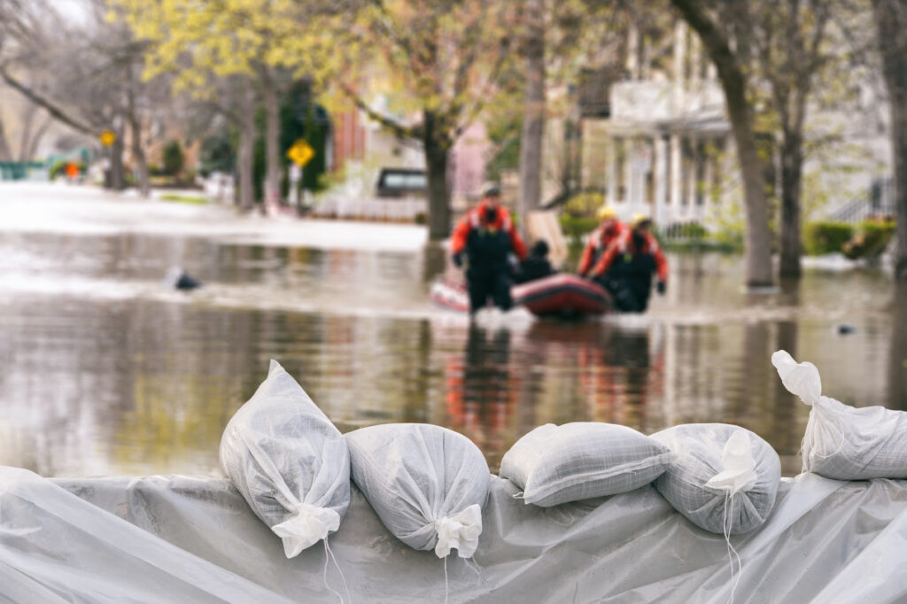
Fifty people died as a direct result of the flooding. The death toll, while significant, was lower than comparable disasters in part because the slow-rising nature of the flood — unlike a flash flood or dam break — allowed for evacuation of many affected areas. But the displacement was enormous. An estimated 74,000 people were forced from their homes, some for months. Entire towns were abandoned, and a handful were never rebuilt, their residents relocated permanently to higher ground.
The economic damage reached approximately $15 billion — roughly $32 billion in today’s dollars — making it one of the costliest natural disasters in American history at the time. More than 20 million acres of farmland were flooded, devastating the 1993 growing season across the corn and soybean belt at the height of summer. Transportation was paralyzed: major highways, rail lines, and river barge traffic were disrupted for months, with ripple effects felt in commodity prices and supply chains nationwide.
What 1993 Changed About Flood Management
The Great Flood of 1993 forced a fundamental rethinking of how the United States approaches river management and flood policy. The levee system, built over decades as a patchwork of federal, state, and local projects, had been designed with the assumption that bigger and stronger levees were always the answer. The 1993 flood revealed the limits of that approach.
In the years following, the federal government began purchasing flood-prone land outright and returning it to natural floodplain rather than rebuilding in the same locations. Buyout programs moved thousands of homeowners out of the highest-risk areas permanently. Some communities that had been repeatedly flooded were relocated entirely. The philosophy shifted — at least in part — from trying to hold rivers in place to giving them room to flood without destroying lives and property.
The flood also accelerated improvements in weather forecasting and hydrological modeling. River forecast models were upgraded, coordination between the National Weather Service and the Army Corps of Engineers improved, and the concept of the “500-year flood” entered mainstream discussion — an acknowledgment that the infrastructure protecting communities needed to account for rare but possible events far beyond the 100-year standard.
Spring Is When It Begins Again
Every spring, the conditions that enabled the 1993 flood reassemble themselves to some degree. Snowmelt fills rivers. Spring rains saturate soil. Reservoirs approach capacity. The question each year is whether the summer weather pattern will be kind — dispersing rainfall broadly and allowing rivers to recede — or whether a stalled system will park itself over a saturated watershed and tip the balance toward disaster.
The Great Flood of 1993 is a reminder that weather events don’t always arrive as sudden, dramatic strikes. Sometimes they build quietly over months, accumulating moisture in the soil, in the rivers, and in the atmosphere until the system has no capacity left. When it finally releases, the result can be a disaster measured not in hours but in an entire lost season — and a landscape that takes years to recover.