A Storm With an Unusual Second Act
Hurricane Ivan made landfall near Gulf Shores, Alabama, on September 16, 2004, as a powerful Category 3 hurricane, causing extensive damage across the central Gulf Coast. That alone would make it a significant storm in hurricane history. What makes Ivan genuinely unusual is what happened afterward: after weakening and crossing the southeastern United States, the storm’s remnant circulation moved back over the Atlantic, reorganized, and looped around to make a second, much smaller landfall in Louisiana nearly two weeks later—an atmospheric path so unusual that it remains one of the more distinctive storm trajectories in modern hurricane records.
A Storm That Reached Category 5 Strength Multiple Times
Before its Gulf Coast landfall, Ivan achieved Category 5 status on three separate occasions as it tracked through the Caribbean, an unusually persistent display of extreme intensity for a single storm. It caused catastrophic damage across Grenada, where it destroyed or damaged the vast majority of buildings on the island, and continued through Jamaica and the Cayman Islands, leaving significant destruction across multiple island nations before ever approaching the U.S. mainland.
By the time Ivan reached the Gulf of Mexico, it had weakened somewhat from its peak intensity but remained an exceptionally powerful and well-organized hurricane, drawing additional energy from the Gulf’s warm late-summer waters as it approached the coast.
Widespread Destruction Across the Central Gulf Coast
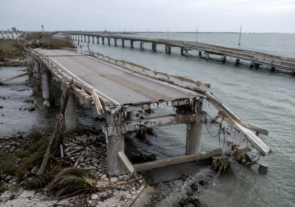
Ivan’s landfall near the Alabama-Florida border produced significant storm surge and wind damage across a wide stretch of coastline, with particularly severe impacts in Pensacola, Florida, and coastal Alabama. The storm caused a partial collapse of a section of the Interstate 10 bridge over Pensacola Bay, an image that became one of the most widely circulated symbols of the storm’s destructive power, illustrating how even substantial infrastructure could be significantly compromised by the storm’s surge and wave action.
Beyond the immediate coastal impact, Ivan’s outer rain bands spawned more than 100 tornadoes across multiple states as the storm’s remnants tracked northward and eastward—a striking demonstration of how a hurricane’s hazards extend well beyond the wind and surge concentrated at its point of landfall, reaching states with no coastal exposure at all.
Significant Damage to Offshore Oil Infrastructure
Ivan’s path took it directly across a significant concentration of oil and gas platforms and pipelines in the Gulf of Mexico, and the storm caused substantial damage to this infrastructure, including platform destruction and pipeline disruptions that took considerable time to fully repair. This damage contributed to disruptions in Gulf oil production and highlighted the vulnerability of offshore energy infrastructure to major hurricanes, a vulnerability that has factored into subsequent industry engineering standards and storm preparedness protocols for offshore platforms.
The Remarkable Second Landfall
After moving inland and weakening into a tropical depression, Ivan’s remnant low-pressure circulation tracked across the southeastern United States and up the East Coast before an unusual atmospheric pattern steered it back out over the Atlantic Ocean. There, drawing on renewed access to warm ocean water, the remnant system reorganized into a new tropical depression and eventually a tropical storm, tracking back across Florida and into the Gulf of Mexico before making a final, much weaker landfall in Louisiana in early October.
This looping path—from the Caribbean, through the Gulf Coast, across the eastern U.S., back out to the Atlantic, and finally back into the Gulf for a second landfall—represents one of the more unusual and rarely repeated storm trajectories in the historical record, illustrating just how complex and occasionally counterintuitive atmospheric steering patterns can become under the right conditions.
A Storm That Reinforced Several Hard Lessons
Ivan’s combination of extreme Caribbean intensity, significant Gulf Coast destruction, extensive inland tornado activity, and substantial offshore infrastructure damage made it one of the more comprehensively destructive hurricanes of the mid-2000s, contributing to the historically active 2004 Atlantic hurricane season. The storm reinforced for emergency planners and infrastructure engineers alike that a hurricane’s threat profile extends across multiple, sometimes geographically distant hazard categories—coastal surge, inland tornadoes, and offshore infrastructure risk—rather than being contained to the immediate area of landfall alone.
A Reminder That Hurricanes Don’t Always Follow a Simple Script
Hurricane Ivan’s unusual double landfall remains a distinctive case study in how complex atmospheric steering patterns can occasionally produce storm behavior that defies the simpler, more linear paths most hurricanes follow. Two decades later, it stands as a reminder that even well-forecast, well-understood storms can still surprise meteorologists with genuinely unusual behavior once they interact with the full complexity of the atmosphere surrounding them.