The System Behind the Storm Coverage
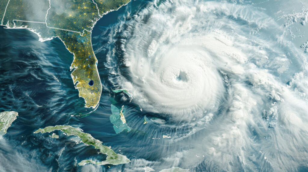
When a tropical storm forms in the Atlantic and receives a name, a specific set of institutional processes activates: the National Hurricane Center begins issuing advisories every six hours, forecast track and intensity models run continuously, and the progression of the storm from tropical depression through potential hurricane is tracked with tools and procedures that have been refined over decades. For most Americans, this system is background — the news shows a cone graphic and a category number, and the details of how those products are created remain opaque.
Understanding how hurricanes are named, what the various advisory products mean, and how the NHC produces its forecasts makes the information that saturates media coverage during hurricane season significantly more useful — and makes it clearer what the forecasts can and cannot tell you.
Why Hurricanes Are Named: The History
The practice of naming tropical storms with human names originated with Australian meteorologist Clement Wragge in the late 19th century, who named storms after politicians he disliked so that he could say they were “causing great distress” in official communications. The modern naming system has more practical origins.
Before named storms, forecasters identified them by their position — “the tropical storm at 22°N, 75°W” — which created confusion when multiple storms existed simultaneously and made communication with the public cumbersome. During World War II, U.S. military meteorologists began informally naming Pacific typhoons after women’s names, a practice that proved operationally useful enough to formalize.
The Atlantic basin adopted formal naming in 1950, initially using the Joint Army/Navy Phonetic Alphabet (Able, Baker, Charlie). In 1953, the NHC shifted to female names exclusively — a decision that reflected the era’s assumptions and that was amended in 1979 to alternate male and female names.
The current naming system uses six pre-established lists that rotate on a six-year cycle. Each list contains 21 names — one for each letter of the alphabet except Q, U, X, Y, and Z, which don’t have enough common names to be practical. The 2026 Atlantic season list, currently in use, runs from names starting with A through W. When a storm is particularly destructive or deadly, its name is retired from future use and replaced with a new name — which is why you won’t see another Hurricane Katrina or Harvey in the Atlantic basin.
If a season exhausts all 21 names — an increasingly common occurrence in active seasons — storms were previously named using the Greek alphabet. Following the active 2020 season, which exhausted the main list and created confusion with multiple Greek-letter storms, the World Meteorological Organization replaced the Greek backup system with a supplemental list of 21 additional names that will be used if the primary list is exhausted.
How a Storm Becomes a Named Hurricane
Tropical systems pass through defined classification thresholds based on maximum sustained wind speed, and each threshold triggers specific NHC advisory products and public attention.
A tropical disturbance is a cluster of organized thunderstorms over warm tropical water with some rotation but no defined circulation center. These are monitored but not named or formally tracked.
A tropical depression forms when a disturbance develops a closed low-pressure circulation with maximum sustained winds below 39 mph. The NHC issues advisories for tropical depressions and assigns them a number (Tropical Depression One, Two, etc.). Most tropical depressions dissipate without intensifying further; a minority strengthen into tropical storms.
A tropical storm has maximum sustained winds of 39 to 73 mph and a well-defined circulation. This is the threshold at which the storm receives a name. The NHC issues full advisory packages for tropical storms, including the forecast track and intensity.
A hurricane has maximum sustained winds of 74 mph or higher. The Saffir-Simpson Hurricane Wind Scale then categorizes the storm from Category 1 through 5 based on wind speed. Category 3 through 5 storms are considered major hurricanes.
The official wind speed measurements that define these categories are based on maximum sustained winds — the highest one-minute average wind speed in the storm. Gusts exceed sustained winds, typically by 25 to 30 percent, which is why peak gusts in a Category 2 hurricane may briefly reach Category 3 speeds.
What the NHC Actually Produces: The Advisory Package
The National Hurricane Center issues advisory packages for every named storm at 5 a.m., 11 a.m., 5 p.m., and 11 p.m. Eastern time, with intermediate advisories at 2 a.m., 8 a.m., 2 p.m., and 8 p.m. when a storm threatens land. Each package contains several distinct products that serve different purposes.
The Public Advisory is the primary communication product — a plain-language summary of the storm’s current location, intensity, movement, and the areas under watches and warnings. It is written for general audiences and provides the essential information most people need.
The Forecast Advisory is a technical product that provides the numerical data — latitude/longitude positions, wind speeds, and sea conditions — at 12, 24, 36, 48, 72, 96, and 120-hour forecast intervals. This is the data that feeds automated systems, maritime services, and technical users.
The Forecast Discussion is the most informative product for people who want to understand the forecast rather than just receive it. Written by the forecasting meteorologist on duty, it explains the reasoning behind the forecast — which models are being trusted, where uncertainty is highest, what could cause the storm to track or intensify differently than forecast. Reading the discussion provides insight into confidence levels that the official forecast cone doesn’t convey.
The Wind Speed Probability products show the probability of tropical storm force (39 mph) and hurricane force (74 mph) winds occurring at any given location within the forecast window. These products are more useful for specific location decision-making than the forecast cone, which shows track uncertainty rather than impact probability.
The Forecast Cone: What It Does and Doesn’t Mean
The forecast cone — the familiar roughly cone-shaped graphic that shows the projected track of a storm — is the most widely recognized hurricane forecast product and the most widely misunderstood.
The cone represents the probable track of the storm’s center over the next five days, drawn so that historically the storm’s center has remained within the cone approximately two-thirds of the time. It does not represent the extent of the storm’s impacts — dangerous winds, storm surge, and rainfall extend far beyond the cone’s edges. A location outside the cone is not necessarily safe from a storm’s effects; it simply has a lower probability of being directly crossed by the storm’s center.
The cone also expands with forecast time, reflecting increasing uncertainty the further out the forecast extends. The wide end of the cone at day five does not mean the storm will be large — it means the forecasters are less certain where it will be at day five than at day one. A storm could be a narrow, compact system while its forecast cone is quite wide.
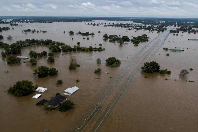
The most common misreading of the cone is treating the edges as the boundary of the storm’s hazards. The storm surge, rainfall, and wind effects from a major hurricane extend hundreds of miles from the center — well outside the cone for most of the storm’s area. The storm surge graphic — a separate product that shows expected surge heights along coastlines — and the wind speed probability products are more useful than the cone for specific impact decision-making.
Hurricane Watches and Warnings
The NHC issues watches and warnings for winds and storm surge separately, a change implemented in 2012 that allows coastal residents to understand which specific hazard they face.
A Hurricane Watch means that hurricane conditions — sustained winds of 74 mph or higher — are possible within the watch area within 48 hours. A watch is the time to prepare: finalize evacuation plans, secure property, gather supplies.
A Hurricane Warning means that hurricane conditions are expected within the warning area within 36 hours. A warning is the time to execute: complete preparations, evacuate if in an evacuation zone, shelter if staying.
Storm Surge Watches and Warnings operate on similar timelines and indicate the risk of life-threatening inundation from storm surge — the hazard that kills the majority of U.S. hurricane fatalities. A storm surge warning for a specific coastal area indicates that dangerous inundation is expected that could be life-threatening to anyone who does not evacuate.
The distinction between watch and warning in both categories, and the distinction between wind and surge products, gives coastal residents specific, actionable information about what to expect and when to act — far more useful than the category number alone, which the hurricane myths piece addressed in detail.
The Season Ahead
The Atlantic hurricane season runs through November 30, with peak activity from mid-August through mid-October. The storms of the current season are being tracked, named, and forecast by the same system described above — a continuous operational process that runs 24 hours a day throughout the season at the NHC facility in Miami.
Following NHC advisory packages directly — particularly the forecast discussions — during any storm that threatens your area provides more nuanced, more honest information about forecast confidence and uncertainty than the simplified coverage that most media produces from the same data. The forecasters who write those discussions are being specific about what they know and don’t know. Reading what they actually wrote is always more informative than reading what a reporter summarized about it.