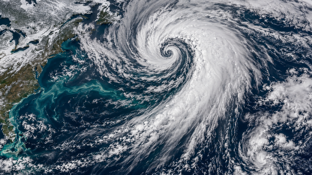
A Dramatic Name for a Real Meteorological Process
When a forecast mentions a bomb cyclone, it sounds like hype, but the term has a precise meaning that meteorologists have used for decades. It describes a storm that strengthens extraordinarily fast, and late fall, when cold air starts surging south while oceans still hold summer warmth, is one of the most favorable times of year for it. Understanding how it works explains why a seemingly ordinary system can turn into a major storm in a single day.
The Technical Definition
The process is called bombogenesis, a word that combines “bomb” with “cyclogenesis,” the development of a storm. By the commonly used definition, a storm qualifies when its central pressure falls by at least 24 millibars within 24 hours, with the threshold adjusted slightly depending on latitude. Falling pressure is a measure of strengthening, because a storm’s winds increase as its center pressure drops relative to its surroundings.
Most storms deepen gradually over several days. A bomb cyclone does the same job in about a day, which is why the term was coined to describe it.
The Ingredients That Make It Happen
Several conditions come together in a bombogenesis event. The first is a sharp temperature contrast along a front, where a mass of cold, dry air meets a mass of warm, moist air. That contrast is a form of stored energy, and the stronger it is, the more fuel a developing storm has.
The second is the jet stream. When a fast-moving trough in the upper atmosphere passes over a surface low-pressure system, it can pull air away from the top of the storm. As that air is removed, more rises from below to replace it, which lowers the pressure at the surface and speeds up the whole circulation.
Warm Ocean Water and Latent Heat
The third ingredient is moisture, and it often comes from warm water. Off the East Coast, the Gulf Stream carries warm water northward, and in late fall, the contrast between that warm water and the colder continental air is large. Air moving over the water picks up heat and moisture, and when that moisture condenses into clouds and precipitation, it releases latent heat into the atmosphere.
This release warms the air in the storm’s core, reinforces the upward motion, and drives the pressure lower still, which draws in even more moisture and heat. The result is a feedback loop that can strengthen the storm much faster than any single factor could on its own.
Why Late Fall Is Prime Time
Bomb cyclones occur mostly in the cooler half of the year, and they’re especially common over the North Atlantic and North Pacific. In November, the planet’s temperature contrasts are growing as the Arctic cools, but the oceans haven’t yet lost their summer heat. That gap provides both the energy contrast and the moisture supply that rapid intensification requires.
This is the same seasonal setup that has produced notorious late-fall storms over the Great Lakes and along the coasts, though not every strong November storm qualifies as a bomb cyclone.
What Bomb Cyclones Bring
The impacts depend on the storm’s track and the air it taps into. A rapidly deepening storm can produce damaging winds, sometimes of hurricane force, and heavy precipitation, with rain on the warm side and snow on the cold side. Along coasts, strong onshore winds can push water ashore, causing coastal flooding and beach erosion.
Inland, where the storm pulls in cold air, the combination of heavy snow and strong wind can create blizzard conditions. A storm doesn’t have to be huge in area to be dangerous, because the intensity packed into its core can be extreme.
How Forecasters Handle These Storms
Forecasters watch for the signs of a developing bomb cyclone by tracking the strength of the temperature gradient, the position of the jet stream, and the forecast pressure falls in computer models. Rapid intensification is one of the harder things to predict, because small differences in the timing of the upper-level trough relative to the surface low can change the outcome. As a result, the forecast of a particular storm’s strength can shift noticeably from one model run to the next, even when the broad risk is well understood.
A Term Worth Understanding
The next time a forecast mentions a bomb cyclone, it’s worth knowing what it signals: a storm strengthening rapidly in the presence of strong temperature contrasts and ample moisture. It doesn’t mean a storm is exploding in a literal sense, but it does mean conditions are favorable for a significant, fast-developing weather event, the kind that calls for paying attention to updated forecasts.