A Distinctive Phenomenon Beginning to Ramp Up
As cold air masses begin pushing south more regularly through late fall, residents downwind of the Great Lakes are entering the early stages of lake-effect snow season, a phenomenon capable of producing some of the most intense, localized snowfall rates found anywhere in the country. Understanding the specific atmospheric mechanism behind lake-effect snow explains why certain areas receive dramatically more snow than locations just a short distance away, even under what seems like broadly similar regional weather conditions.
The Fundamental Ingredient: A Temperature Contrast
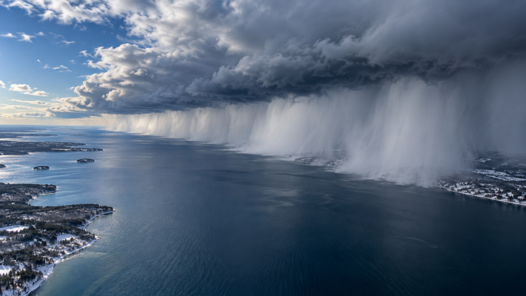
Lake-effect snow develops from a straightforward but powerful physical principle: when cold air moves across a relatively warmer body of water, it picks up both heat and moisture from the lake surface, and this newly warmed, moisture-laden air becomes unstable and rises, eventually cooling enough for that moisture to condense and fall as snow once the air mass reaches the opposite shore and is forced to rise further by the terrain there.
This process depends heavily on the temperature difference between the lake water and the air passing over it. Great Lakes water, which retains summer-accumulated heat well into fall and early winter due to water’s high heat capacity, often remains considerably warmer than the increasingly cold air masses beginning to move across the region during this transitional period, creating exactly the temperature contrast lake-effect snow requires. This is part of why lake-effect snow season typically begins in earnest in November and continues through winter until the lakes themselves eventually freeze over, at which point the open water surface needed to fuel the process is no longer available.
Why Snow Bands Form in Such Narrow, Intense Strips
One of lake-effect snow’s most distinctive characteristics is how narrow and locally intense the resulting snow bands can be, sometimes producing several feet of snow in one location while an area just a few miles away receives only light flurries or nothing at all. This narrow banding occurs because the rising, moisture-laden air columns generated by the lake’s warming effect tend to organize into relatively narrow, parallel bands aligned with the wind direction, rather than spreading evenly across a wide area.
The specific location and orientation of these snow bands depends heavily on wind direction, meaning a shift of just a few degrees in wind direction can shift an intense snow band’s path considerably, explaining why lake-effect snow forecasts often carry more locational uncertainty than forecasts for broader, more evenly distributed snow events.
Why Fetch Distance Matters
The distance cold air travels across open water—called fetch—significantly influences how much moisture and instability the air mass accumulates before reaching the opposite shore. A longer fetch distance across open water generally allows more time for the air to absorb heat and moisture from the lake surface, often producing more intense resulting snowfall compared to a shorter fetch distance. This is part of why certain locations downwind of the Great Lakes, positioned to receive wind that has traveled across the longest possible stretch of open water for a given wind direction, have developed reputations as particularly snow-prone lake-effect locations.
Why Terrain on the Downwind Shore Matters Too
Once the moisture-laden air reaches the opposite shore, terrain features play a significant additional role in determining where the heaviest snow actually falls. Hills and elevated terrain force the rising air even higher, enhancing the cooling and condensation process and often producing the heaviest snowfall totals at somewhat elevated locations a short distance inland from the immediate shoreline, rather than directly at the water’s edge itself.
This terrain-enhancement effect is part of why some of the most extreme lake-effect snowfall totals on record have occurred not immediately along a lake shore, but rather several miles inland, where elevated terrain provides the additional lift needed to maximize the snow-production process already set in motion by the lake effect itself.
Why This Process Eventually Shuts Off
Lake-effect snow production naturally diminishes and eventually stops once the temperature contrast between lake water and overlying air becomes insufficient to drive the process, which typically happens as the lakes themselves gradually cool through the winter season and, in colder winters, eventually develop ice cover that eliminates the open water surface the entire mechanism depends on. This is why lake-effect snow season has a natural arc through the winter, typically most active in the early-to-mid winter months before lake temperatures drop enough, or ice cover develops enough, to significantly reduce the phenomenon’s intensity later in the season.
A Distinctly Regional Phenomenon With Outsized Impact
Lake-effect snow represents one of the more dramatic examples of how a specific, relatively localized geographic feature can produce weather effects wildly disproportionate to the broader regional weather pattern surrounding it. As cold air masses become an increasingly regular feature of the forecast in the weeks ahead, this distinctive phenomenon will likely begin producing its characteristic narrow, intense snow bands for communities positioned downwind of the Great Lakes, delivering some of the most locally extreme snowfall totals found anywhere in the country from a mechanism entirely dependent on the specific interaction between cold air and relatively warm, open lake water.