A Genuinely Rare and Startling Phenomenon
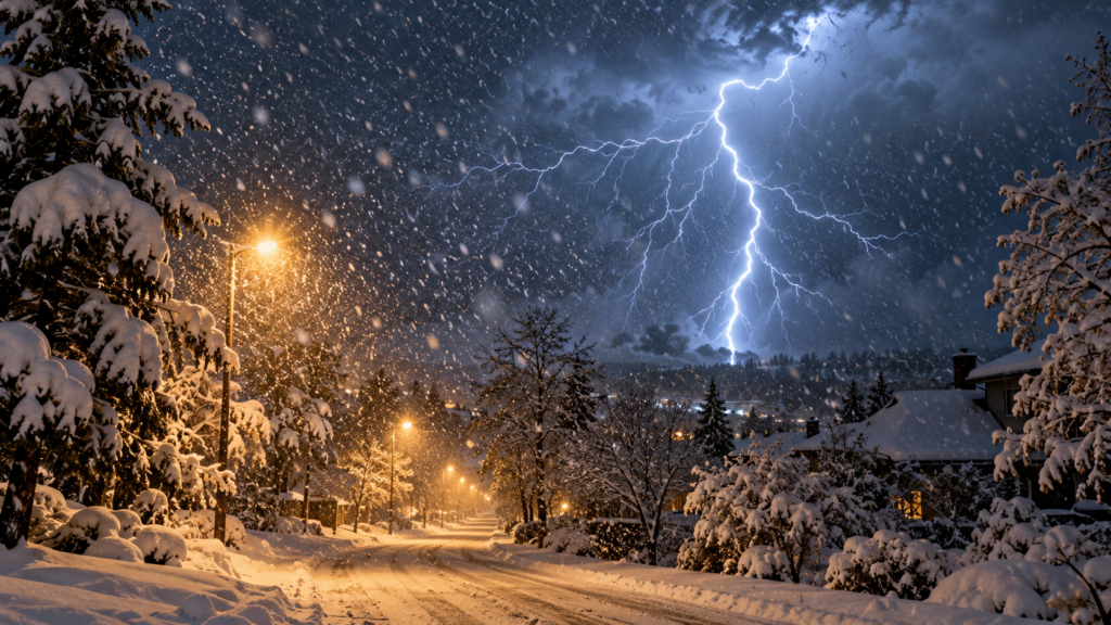
As the first snow events of the season begin appearing on forecasts for northern regions, it’s worth understanding one of winter weather’s most unusual and startling phenomena: thundersnow, a genuine thunderstorm that produces snow instead of rain, complete with lightning and thunder occurring during active snowfall. While most people associate thunder and lightning exclusively with summer storms, the same basic atmospheric mechanism can, under the right circumstances, occur during a winter snowstorm instead.
The Same Basic Ingredients, in an Unusual Combination
Thunderstorms, whether producing rain or snow, require three fundamental ingredients: moisture, instability (meaning warmer air near the surface with colder air above, encouraging air to rise), and a lifting mechanism to actually get that rising motion started. Summer thunderstorms typically develop this instability through intense surface heating from strong summer sun, creating a sharp temperature contrast between sun-warmed ground-level air and the cooler air aloft.
Thundersnow requires a similar instability setup, but achieved through a different mechanism, since the sun-driven heating responsible for most summer thunderstorm instability isn’t available during a winter snow event. Instead, thundersnow typically develops when a layer of relatively milder air exists near the surface, often associated with a strong low-pressure system, while significantly colder air sits above it, creating the same fundamental instability pattern through a completely different seasonal process.
Why Thundersnow Is So Much Rarer Than Summer Thunderstorms
The specific combination of factors needed to produce genuine thundersnow is considerably harder to achieve than the conditions producing an ordinary summer thunderstorm, which is why thundersnow events remain genuinely uncommon even in regions that experience frequent winter storms. Strong low-pressure systems capable of producing the necessary instability, combined with sufficient moisture and a cold enough atmosphere to support snow rather than rain throughout the storm’s full vertical extent, represents a narrower set of atmospheric conditions than the more commonly achieved summer thunderstorm setup.
Thundersnow tends to occur most frequently in specific situations: strong winter cyclones with an unusually pronounced temperature gradient, lake-effect snow bands downwind of the Great Lakes (where the lake’s relative warmth compared to overlying cold air can provide the instability needed), and occasionally along the heavier precipitation bands of significant winter storms more broadly.
Why Thunder Sounds Different During Thundersnow
People who’ve experienced thundersnow often describe the thunder itself as sounding noticeably different from typical summer thunder—often more muffled, less sharp, and audible over a considerably shorter distance. This difference relates directly to how the thick snow layer actually present during the event affects sound transmission: falling and accumulated snow absorbs and dampens sound waves considerably more effectively than clear air, muffling and shortening the thunder’s audible range compared to how the same thunder would sound during a clear or rainy summer storm.
This acoustic dampening effect means thunder during a thundersnow event is often heard only within a few miles of the lightning strike itself, compared to summer thunder, which can sometimes be heard from considerably greater distances under favorable atmospheric conditions.
A Visually Striking, Genuinely Useful Forecasting Signal
Beyond its novelty, thundersnow carries genuine practical significance for meteorologists and anyone experiencing a winter storm. The presence of lightning within a snowstorm typically indicates the storm possesses unusually strong internal dynamics and instability, which often correlates with significantly higher snowfall rates in the immediate vicinity of the lightning activity compared to the broader storm system. Meteorologists sometimes specifically watch for lightning reports during major winter storms as an indicator of where the most intense, heaviest snowfall bands are likely occurring in real time, since this correlation between thundersnow and locally extreme snowfall rates has proven reasonably reliable.
A Reminder That Severe Weather Isn’t Confined to One Season
Thundersnow serves as a striking reminder that the fundamental atmospheric processes producing thunderstorms aren’t exclusively tied to summer heat, but rather to a more general instability pattern that can, under the right circumstances, develop during winter’s coldest months as well. As the season’s first significant snow events approach for many regions, this rare phenomenon represents one of winter weather’s more genuinely fascinating possibilities, a visible reminder of how the same basic atmospheric physics can produce dramatically different, season-spanning results depending on the specific conditions present when instability finally triggers active convection.