May 18, 1980
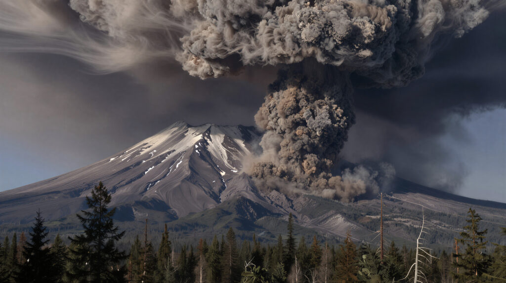
At 8:32 a.m. on May 18, 1980, a magnitude 5.1 earthquake triggered the largest landslide in recorded history on the north face of Mount St. Helens in southwestern Washington State. The collapse of the mountain’s north flank released pressure on a magma chamber that had been inflating for two months, producing a lateral volcanic blast that traveled at 300 miles per hour and flattened 230 square miles of old-growth forest in less than three minutes. The eruption column that followed rose 80,000 feet into the stratosphere — 15 miles above Earth’s surface — carrying 520 million tons of ash that would circle the globe and affect weather patterns across the Northern Hemisphere for more than a year.
Fifty-seven people died, including volcanologist David Johnston, who was monitoring the mountain from a ridge 6 miles away and transmitted the eruption’s first radio report — “Vancouver! Vancouver! This is it!” — moments before the lateral blast reached him. The eruption remains the deadliest and most economically destructive volcanic event in modern American history, and it is also one of the most significant unplanned atmospheric science experiments of the 20th century.
The Mountain That Had Been Warning for Months
Mount St. Helens did not erupt without warning. Beginning in March 1980, a series of earthquakes and small steam explosions signaled that magma was moving beneath the mountain. Scientists from the United States Geological Survey established monitoring networks and began tracking a dramatic physical change: the mountain’s north flank was bulging outward at the rate of five to six feet per day as magma pushed into the volcanic edifice from below.
By early May, the bulge extended nearly 450 feet beyond the mountain’s original profile. Geologists knew a major eruption was likely and probable but could not predict its precise timing or character. A hazard zone was established around the mountain, and most residents and visitors were evacuated. Some, however, refused to leave — most famously Harry Truman, the 83-year-old innkeeper of Mount St. Helens Lodge at Spirit Lake, who had lived on the mountain for decades and declined evacuation. He died in the eruption.
The eruption’s lateral character — the blast moving horizontally rather than purely vertically — was not fully anticipated and contributed to casualties among people who believed they were at a safe distance from a vertical eruption. The lateral blast extended 8 miles north of the crater at its widest point, far beyond the hazard zone boundaries that had been established based on expectations of a more conventional eruption column.
The Atmospheric Science of the Eruption
For atmospheric scientists, the Mount St. Helens eruption was a natural experiment of extraordinary scale and detail — the first major volcanic eruption of the satellite era, occurring in a country with a dense network of weather stations, research aircraft, and atmospheric monitoring equipment.
The eruption injected material into the atmosphere in two distinct forms with different atmospheric effects. The ash cloud — fine particles of pulverized rock — rose to 80,000 feet in the initial eruption column and spread eastward on stratospheric winds. Within three days, the ash cloud had crossed the United States. Within two weeks, it had circled the globe. Ash fell visibly in communities across the Pacific Northwest, the northern Rockies, and the northern Plains — Yakima, Washington received a half inch of ash, turning day to night and requiring snowplows to clear streets.
The sulfur dioxide injected into the stratosphere had more lasting atmospheric effects. Volcanic SO₂ reacts with water vapor in the stratosphere to form sulfuric acid aerosols — tiny droplets that scatter incoming solar radiation back to space. This scattering reduces the amount of solar energy reaching Earth’s surface, producing a cooling effect that can persist for months to years depending on the quantity of SO₂ injected and the altitude it reaches.
Mount St. Helens injected approximately 1 million tons of SO₂ into the stratosphere. This is modest by the standards of truly large volcanic eruptions — the 1991 eruption of Mount Pinatubo in the Philippines injected 20 million tons, producing a measurable global cooling of approximately 0.5°C for more than a year. St. Helens produced a smaller and more regional atmospheric effect, with stratospheric aerosol measurements detecting the volcanic signal clearly but surface temperature impacts that were detectable statistically but not dramatically visible in weather records.
How the Ash Cloud Moved
The behavior of the Mount St. Helens ash cloud provided one of the first detailed observational datasets on how volcanic material disperses through the atmosphere — information that has since been used to improve models of both volcanic ash transport and the broader movement of atmospheric aerosols.
The eruption occurred during a period when the jet stream was carrying air from the Pacific Northwest eastward across the northern United States. The ash column, reaching into the stratosphere, was picked up by winds at multiple levels — surface winds carried heavier particles eastward and they settled within a few hundred miles, while finer particles entrained in the jet stream traveled much farther before settling.
The pattern of ash deposition reflected both the wind field and particle size. The heaviest ash fell in a corridor extending east-northeast from the mountain — across central Washington, northern Idaho, and western Montana. Measurable but lighter ash fell across the northern tier of states from the Dakotas to the Great Lakes. The finest stratospheric particles dispersed globally over weeks.
Weather stations across the Pacific Northwest recorded dramatic effects during and immediately after the eruption: surface temperatures dropped as ash blocked sunlight, relative humidity increased as ash particles served as condensation nuclei for water vapor, and visibility dropped to near zero in heavily affected areas. Yakima, 80 miles downwind, received its ash fall in near-total darkness despite it being mid-morning.
The Year After: Atmospheric Monitoring and Discovery
The months following the eruption produced a sustained scientific effort to track the atmospheric effects of the volcanic injection — one of the first systematic volcanic aerosol monitoring campaigns of the modern era.
Lidar measurements — radar-like instruments that use laser pulses rather than radio waves to detect atmospheric layers — tracked the stratospheric aerosol layer as it circulated around the Northern Hemisphere. Balloon-borne instruments sampled the aerosol composition directly. Surface radiation measurements detected the slight reduction in direct solar radiation that the aerosol layer produced.
The data gathered from the St. Helens aerosol campaign directly informed the scientific response to subsequent eruptions, particularly the vastly larger Pinatubo eruption in 1991. When Pinatubo’s SO₂ cloud began circulating in the stratosphere, scientists already had the conceptual and instrumental framework developed partly from St. Helens experience to predict and document the global cooling that followed — a prediction that verified remarkably well and became one of the landmark demonstrations of atmospheric science’s predictive capability.
What Volcanoes Tell Us About the Atmosphere
The Mount St. Helens eruption belongs in a discussion of weather science because volcanoes are among the most powerful natural experiments available for understanding how the atmosphere responds to perturbations. They inject material into the stratosphere at known times, in measurable quantities, and the atmospheric response — aerosol formation, radiation scattering, temperature effects, circulation changes — can be tracked and compared against models.
The history of volcanic climate effects extends far back in the scientific record. The 1815 eruption of Mount Tambora in Indonesia injected enough SO₂ to produce the “Year Without a Summer” in 1816 — crop failures across the Northern Hemisphere, snow in June in New England, famine in Europe. The 1883 Krakatoa eruption produced spectacular red sunsets around the world for more than a year as its stratospheric aerosols scattered light. These historical eruptions, studied retrospectively through ice cores, tree rings, and historical records, have helped calibrate our understanding of how volcanic forcing affects climate.
Mount St. Helens, 45 years ago today, added to this understanding in a uniquely well-documented way — caught in full by the instruments and satellites of the modern scientific era, occurring in a country with the resources to study it intensively, and producing atmospheric effects that were measurable, trackable, and scientifically illuminating even if they were modest by the standards of the geological record.
The Mountain Today
Mount St. Helens remains an active volcano. A lava dome has been slowly rebuilding inside the crater since the 1980 eruption, interrupted by a period of renewed activity from 2004 to 2008 that added significantly to the dome’s size. The mountain that once stood at 9,677 feet now tops out at 8,365 feet — the 1,300 feet of elevation lost in the 1980 collapse is gone permanently, redistributed as debris across the Toutle River valley and the ash fields downwind.
The blast zone — the area of flattened forest north of the crater — has been recovering for 45 years, and the ecological succession occurring there has become one of the most intensively studied examples of ecosystem recovery after catastrophic disturbance. Species returned in unexpected sequences, colonizing the devastated landscape in ways that challenged prevailing theories about ecological succession and generated decades of productive scientific inquiry.
The mountain that erupted on May 18, 1980 changed the landscape, the atmosphere, and the scientific understanding of both. On its 45th anniversary, it remains a reminder of how dramatically and suddenly the Earth’s geology can intervene in the atmosphere’s chemistry — and how much there is to learn when it does.