The River of Wind Six Miles Above Your Head
Every time a meteorologist explains why a storm is tracking the way it is, or why temperatures are unusually warm or cold for the season, the jet stream is almost always part of the answer. It’s one of the most frequently referenced features in weather forecasting — and one of the least understood by the people hearing about it. The jet stream is real, it’s measurable, and it has more influence over the day-to-day and week-to-week weather you experience than almost any other atmospheric feature.
Understanding what it is, why it exists, and how its behavior in spring differs from other seasons explains patterns you’ve noticed your entire life without having a framework for.
What the Jet Stream Actually Is
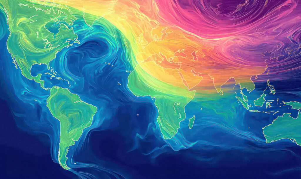
The jet stream is a narrow band of fast-moving air in the upper troposphere — roughly 25,000 to 40,000 feet above sea level, or five to seven miles up. It flows from west to east around the globe, typically at speeds of 80 to 140 miles per hour, though it can exceed 200 miles per hour in its strongest segments. Commercial aircraft flying eastward routinely ride the jet stream to reduce travel time and fuel consumption. Flying westward against it adds hours to the same route.
There isn’t just one jet stream. The Northern Hemisphere has two primary jet streams: the polar jet stream, which is the stronger and more weather-relevant one that affects most of the United States, and the subtropical jet stream, which sits farther south and plays a larger role in the weather of the southern states and Mexico.
The polar jet stream is not a fixed feature. It meanders, strengthens, weakens, shifts north and south, and occasionally breaks down into disconnected segments. This variability is not random — it’s driven by the temperature contrast between polar and tropical air masses, and that contrast changes systematically with the seasons.
Why the Jet Stream Exists
The jet stream is fundamentally a consequence of Earth’s rotation combined with the temperature difference between the equator and the poles.
The equator receives more solar energy than the poles, creating a persistent temperature gradient — warm air near the equator, cold air near the poles. Warm air is less dense than cold air, and this density difference creates pressure gradients in the atmosphere. In the upper atmosphere, these pressure gradients drive air from the warm equatorial regions toward the cooler polar regions.
Earth’s rotation deflects this poleward-moving air to the right in the Northern Hemisphere — a phenomenon called the Coriolis effect. Instead of flowing directly from equator to pole, the air curves eastward, eventually flowing parallel to the lines of latitude rather than crossing them. The result is a fast-moving river of upper-level westerly winds that encircles the globe: the jet stream.
The jet stream’s speed at any location reflects the strength of the temperature contrast across it at that point. Where the contrast between cold polar air and warm subtropical air is greatest, the jet stream accelerates. Where the contrast is smaller, it slows. The boundary between cold and warm air masses — the polar front — and the jet stream directly above it are essentially the same feature viewed from the surface versus the upper atmosphere.
Why the Jet Stream Steers Weather Systems
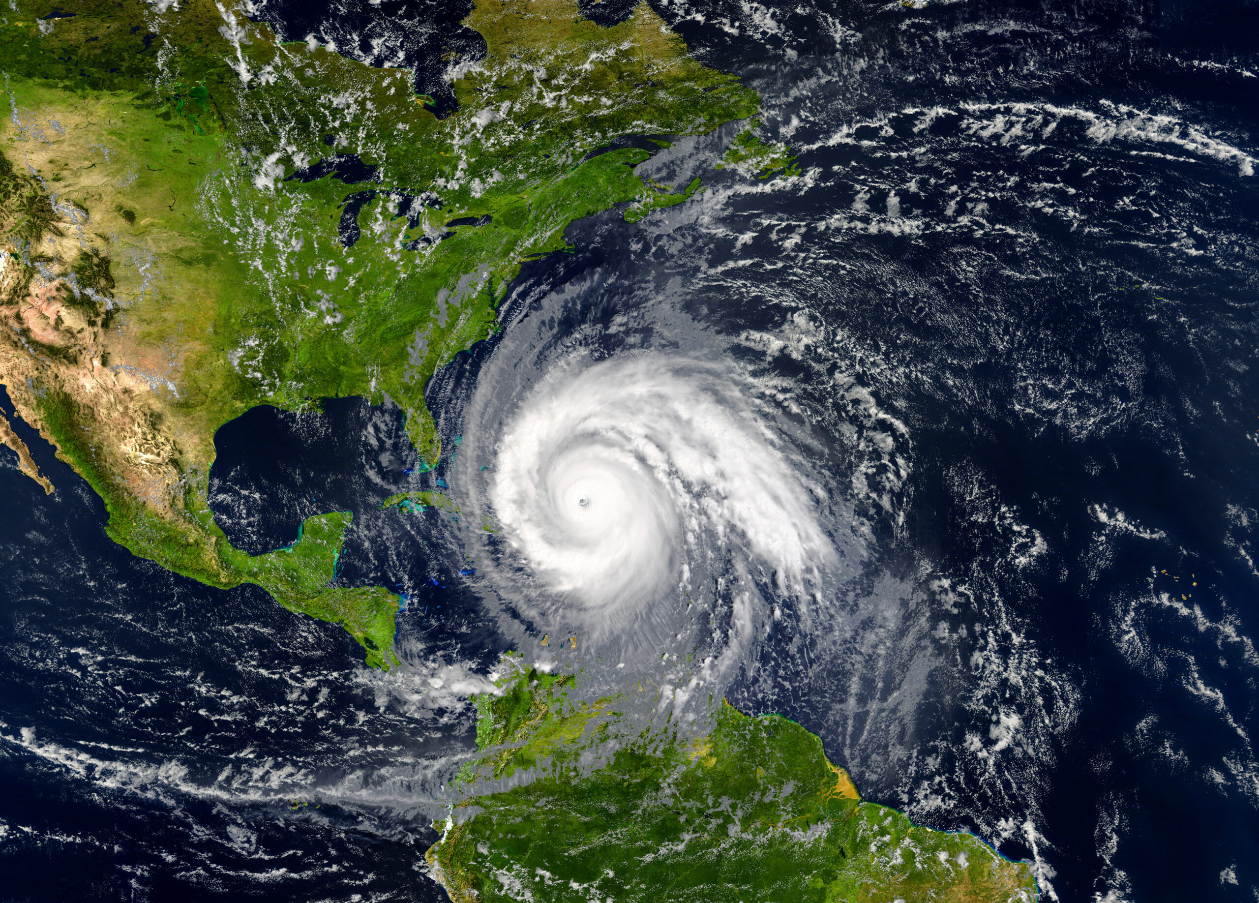
The jet stream’s importance for surface weather comes from its role in steering the storm systems that develop below it. Low-pressure systems — the extratropical cyclones that produce multi-day rain and snow events across the country — form along the polar front and are carried by the winds in the jet stream above them. Where the jet stream goes, the storms follow.
When the jet stream runs relatively straight from west to east — a pattern meteorologists call a zonal flow — storm systems move quickly across the country and neither extreme cold nor extreme warmth lingers for long. Weather is changeable but not prolonged. This pattern tends to produce mild, relatively unremarkable conditions across most of the country.
When the jet stream develops large north-south undulations — called Rossby waves or planetary waves — the weather pattern becomes amplified and persistent. A southward dip in the jet stream, called a trough, brings cold polar air deep into the lower latitudes and steers storm systems southward. A northward bulge, called a ridge, blocks cold air from moving south and allows warm air to surge northward. These amplified patterns are responsible for the prolonged cold snaps, heat waves, and drought periods that characterize extreme weather seasons.
When a ridge becomes particularly strong and stationary — a blocking pattern — it can hold a weather pattern in place for weeks at a time. The persistent rainfall pattern that produced the Great Flood of 1993 was a blocking pattern: a stationary ridge over the eastern United States held a trough over the Midwest in place for most of the summer, repeatedly steering storm systems over the same already-saturated watershed.
The Jet Stream in Spring
Spring is when the polar jet stream is at its most active and most influential over the continental United States, for reasons directly tied to the season’s defining characteristic: extreme temperature contrasts.
In winter, the jet stream is strong but positioned relatively far south, reflecting the deep cold that extends well into the lower latitudes. In summer, the jet stream weakens significantly and retreats to the northern border of the country and into Canada, reflecting the reduced temperature contrast as the entire continent warms.
Spring is the transition: the surface and lower atmosphere are warming rapidly, but the upper atmosphere is still cold from winter. The contrast between the rapidly warming surface air — pulled toward warmer temperatures by the strengthening sun — and the cold air aloft is at its seasonal maximum in March, April, and May. This extreme contrast strengthens the jet stream to near its maximum annual intensity precisely when it’s positioned directly over the most populated parts of the country.
The result is the active spring storm track that produces the season’s frequent rain events, severe thunderstorms, and tornado outbreaks. Every major severe weather event in spring — the supercell thunderstorms, the flooding rain systems, the late-season snow events — is organized and steered by the jet stream. Its position on any given day determines whether storms track through the northern Plains or the Ohio Valley, whether the Southeast gets rain or drought, whether the Northeast stays mild or gets one more cold outbreak.
Why Some Springs Feel More Volatile Than Others
Year-to-year variation in spring weather patterns is largely a function of how the jet stream behaves. Some springs feature a relatively straight, progressive jet stream that moves storm systems through quickly and prevents any single weather pattern from dominating. These springs feel variable but not extreme — alternating mild and cool periods, regular but not exceptional rainfall.
Other springs feature a highly amplified, wavy jet stream with strong ridges and troughs that become semi-stationary for weeks at a time. These are the springs that produce prolonged flooding in one region while another region stays locked in drought; that deliver one severe weather outbreak after another to the same areas of the country; that keep bringing cold air back to regions that should have transitioned to spring weeks earlier.
The factors that determine which pattern dominates in a given year involve the ocean temperatures, snow cover extent, and Arctic sea ice conditions that influence the temperature contrasts driving the jet stream’s behavior. This is an active area of research, and long-range forecasting of jet stream behavior — predicting which spring pattern will dominate weeks in advance — remains one of meteorology’s most challenging problems.
The Thread Connecting Everything
If you’ve read through this series over the past several months, you’ve encountered the jet stream repeatedly: steering the Storm of the Century up the East Coast, holding the stalled pattern that produced the Great Flood of 1993, driving the wind shear that makes spring supercells so much more violent than summer storms, explaining why March winds are stronger than August winds.
The jet stream is the thread that connects all of these phenomena because it is the dominant organizing feature of mid-latitude weather. Everything that happens in the atmosphere below it — the storm systems, the air mass boundaries, the temperature patterns, the precipitation — is shaped by its position, strength, and behavior.
It’s invisible from the ground, inaccessible to direct experience, and yet it’s the reason your weekend looks the way it does. That’s what makes it worth understanding.