Thunder Season Has Arrived—Here’s Why It Peaks Right Now
Late March through June is the most active severe weather period in the United States, and that’s not a coincidence. The same atmospheric conditions that make spring so changeable and unpredictable also create the ideal recipe for powerful thunderstorms—sometimes including tornadoes, large hail, and damaging winds. Understanding why spring is prime thunderstorm season reveals the core physics of how these storms form and why certain combinations of ingredients, all present right now, produce the most violent weather the atmosphere can generate.
Three Ingredients Make a Thunderstorm
Every thunderstorm, from a brief afternoon shower to a violent supercell, requires the same three basic ingredients: moisture, lift, and instability. Spring delivers all three in abundance—and in combinations more extreme than any other season.
Moisture is the fuel. Warm, humid air contains enormous amounts of water vapor, and when that air rises, the vapor condenses into cloud droplets, releasing latent heat that powers the storm’s updraft. By late March, the Gulf of Mexico has warmed enough to pump a steady stream of warm, moist air northward into the central and eastern United States. This moisture return—as meteorologists call it—is one of the defining features of spring weather and the essential first ingredient.
Lift is the trigger. Something has to force that moist air upward to start the storm process. In spring, lift comes from multiple sources simultaneously: cold fronts pushing under warm air and forcing it upward, low-pressure systems drawing air inward and upward, daytime heating causing air near the ground to rise as thermals, and terrain features like hills and mountains deflecting air flow. Spring’s active weather pattern means lift mechanisms are abundant and frequent.
Instability is what makes storms explosive rather than just cloudy. The atmosphere is unstable when air near the surface is significantly warmer and more buoyant than air aloft. When a parcel of this surface air gets pushed upward, it rises faster and faster because it keeps being warmer—and therefore lighter—than its surroundings, like a hot air balloon that keeps accelerating the higher it goes. This runaway rising motion is what creates a thunderstorm’s powerful updraft.
Spring maximizes instability because surface air warms rapidly under the strengthening sun while the upper atmosphere is still cold from winter. The temperature contrast between the warm surface and cold upper levels creates extreme buoyancy—the atmospheric equivalent of a coiled spring waiting to release.
Why Spring Storms Are More Violent Than Summer Storms
Summer produces plenty of thunderstorms, but they’re typically shorter-lived and less organized than spring storms. The reason comes down to wind shear—the change in wind speed and direction with altitude.
In summer, the jet stream has retreated far to the north and weakened considerably. Upper-level winds are relatively light and uniform. Without strong wind shear, thunderstorms tend to grow straight up, rain out their own updraft, and weaken quickly. They’re often intense but brief.
In spring, the jet stream is still powerful and positioned directly over the United States. Wind shear is extreme—surface winds might blow from the south at 15 mph while winds at 30,000 feet blow from the west at 100 mph. This dramatic change in wind with altitude does something remarkable to thunderstorms: it tilts them.
A tilted thunderstorm separates its updraft from its downdraft. Instead of the storm raining on itself and cutting off its own fuel supply, the rain and cold air fall in a different location than the warm, rising air entering the storm. This allows the updraft to sustain itself for hours, growing into a massive, organized storm system called a supercell.
Supercells are the most dangerous thunderstorms on Earth. They produce the vast majority of significant tornadoes, most large hail, and extreme wind events. They exist almost exclusively in spring and early summer, precisely because that’s when wind shear is strongest.
The Dryline: Spring’s Unique Storm Trigger
One of the most important weather features of spring storm season is something most people have never heard of: the dryline. This is a boundary that forms almost daily across the southern Great Plains—Texas, Oklahoma, Kansas—where dry desert air pushing east from the Rocky Mountains meets moist Gulf air pushing west. The contrast in humidity across this boundary can be dramatic: relative humidity might be 70 percent on the moist side and 15 percent just twenty miles west.
As afternoon heating strengthens, the dryline surges eastward, and where it collides with moist Gulf air, it provides powerful lift. Many of the most violent tornado outbreaks in U.S. history have been triggered by storm development along the dryline in late March, April, and May. Even if you don’t live in Tornado Alley, storms that develop along the dryline often travel hundreds of miles before weakening, eventually affecting areas far removed from where they formed.
Hail: Spring’s Most Underestimated Hazard
Most people think of tornadoes as the primary spring storm threat, but hail causes more total property damage in the United States than any other thunderstorm hazard—billions of dollars annually in damage to vehicles, crops, roofs, and outdoor equipment.
Hail forms inside thunderstorms when updrafts carry raindrops high enough into the subfreezing upper atmosphere that they freeze. The frozen pellet then gets coated with additional water as it circulates through the storm, growing larger with each trip through the updraft before eventually becoming heavy enough to fall. Strong spring updrafts—powered by that extreme instability—can keep hailstones aloft long enough to grow to golf ball size or larger.
The hail threat extends far beyond Tornado Alley. Large hail events occur across the entire country wherever strong spring thunderstorms develop, making it the most geographically widespread of spring’s severe weather hazards.
Understanding the Tornado Connection
Tornadoes are the most iconic spring weather phenomenon, and spring truly is their season—roughly 70 percent of annual U.S. tornadoes occur between March and June, with the peak in May. The connection to spring thunderstorm dynamics is direct.
Tornadoes form from supercell thunderstorms when a specific set of additional ingredients align: strong wind shear at low levels that creates horizontal rotation in the atmosphere, powerful updrafts that tilt that horizontal rotation into the vertical, and a feature called a mesocyclone—a rotating column of air within the thunderstorm—that can eventually concentrate into a tornado.
Not every supercell produces a tornado, and not every spring storm is a supercell. But when conditions align—and they align far more often in spring than any other season—the result can be one of nature’s most destructive phenomena.
What to Watch For on Your Forecast
Modern meteorology can identify the conditions conducive to severe thunderstorms days in advance. When you see certain terms in forecasts during spring, they carry specific meaning worth understanding.
A Slight Risk or Enhanced Risk for severe weather from the Storm Prediction Center means organized severe thunderstorms are possible in that area. A Moderate Risk means significant severe weather is likely, including the possibility of strong tornadoes. A High Risk—the rarest category—signals the potential for a major, life-threatening outbreak and is issued only a few times per year.
When these outlooks are issued for your area, taking them seriously and having a plan before storms arrive is the right response. Know where your safe shelter is. Keep a weather radio or reliable weather app on hand. Spring storms can move fast, and the window between a tornado warning and storm arrival can be measured in minutes.
The Season’s Most Spectacular—and Serious—Weather
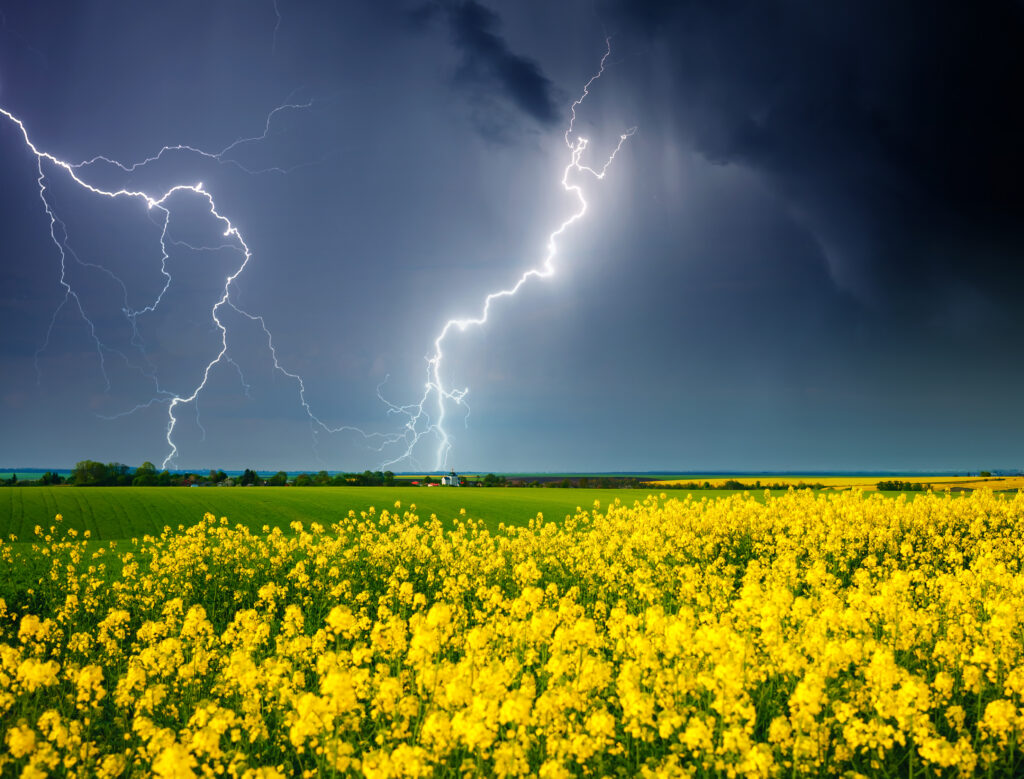
Spring thunderstorms are extraordinary to witness from a safe location. The towering cumulonimbus clouds, the lightning displays, the dramatic shifts in wind and pressure as a storm approaches—these are among the most visually stunning phenomena in the atmosphere. But they’re also genuinely dangerous, and late March through June is the time of year to take weather awareness most seriously.
Understanding why spring storms form and what makes them so powerful puts you in a better position to appreciate them safely—knowing when to watch, when to seek shelter, and why this particular season brings the atmosphere to its most energetic and volatile state of the year.