Understanding How Terrain, Wind, and Local Features Create Extreme Snowfall Differences
Check snowfall totals after a winter storm and you might find puzzling variations: your house received 8 inches while your neighbor three streets away got 12 inches. One side of town reports 6 inches while the other side claims 14 inches. A weather station five miles away measured 10 inches while you dug out from 18 inches. These dramatic differences in snow accumulation over short distances aren’t measurement errors or exaggeration—they’re real variations caused by microclimates, topography, wind patterns, and local features that create vastly different accumulation even within the same general storm system. Understanding why snow depths vary so dramatically reveals how small-scale factors influence weather in ways that forecasters can’t always predict.
Elevation Creates Temperature Boundaries
Even modest elevation changes dramatically affect snow accumulation:
Temperature drops approximately 3.5°F per 1,000 feet of elevation gain. In a marginal storm where temperatures hover near 32°F, this gradient determines who gets snow and who gets rain.
Areas just 200-300 feet higher than surrounding neighborhoods can receive all snow while lower elevations see rain or mix. This translates to zero accumulation versus 6-8 inches over a distance of just a few blocks.
Hills and ridges in otherwise flat terrain create enough elevation difference to change precipitation type. The top of even a modest 150-foot hill might accumulate snow while the base sees rain.
Valley floors often stay warmer than surrounding slopes, experiencing rain while hillsides get snow—visible after storms as a distinct “snow line” at a particular elevation.
In cities with topography—San Francisco, Seattle, Pittsburgh, Cincinnati—elevation differences of a few hundred feet between neighborhoods routinely create dramatically different accumulation totals from the same storm.
Even without mountains, small hills and valleys create microclimates that affect whether precipitation falls as rain or snow, completely changing local totals.
Wind Redistribution Changes Everything
Wind is perhaps the single biggest factor in variable snow accumulation:
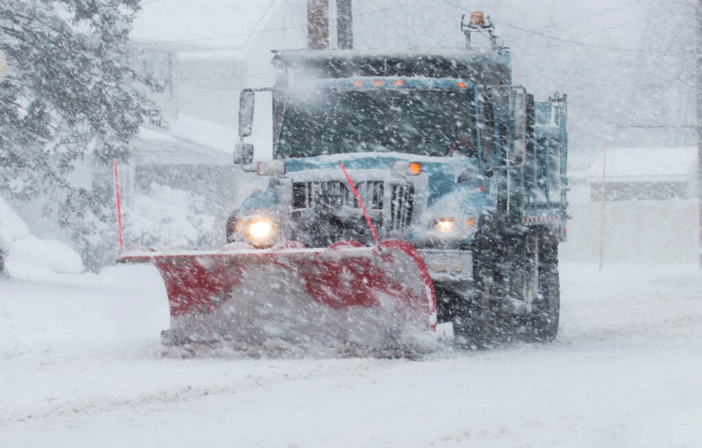
Blowing snow during and after storms redistributes accumulation unevenly. Snow doesn’t remain where it initially fell—wind moves it, often dramatically.
Drifting creates massive accumulations in some spots while leaving others nearly bare. The same storm might produce 2-foot drifts in one yard and 6 inches in the next, with an average accumulation of 10 inches.
Wind shadow effects occur behind buildings, fences, hills, and vegetation. These areas receive reduced wind speeds, allowing snow to settle and accumulate rather than blowing through.
Wind-exposed areas lose snow to blowing, with some areas seeing net loss—more snow blows away than falls—resulting in less accumulation than actual precipitation would suggest.
Urban environments create complex wind patterns. Buildings channel wind down streets or create eddies that deposit snow in specific locations. One block might accumulate heavily while a parallel street two blocks away remains relatively clear.
Measuring snow depth accurately becomes nearly impossible with significant wind, as every measurement point shows different depth based on local drift patterns rather than actual precipitation.
The Fetch Effect and Open Spaces
Open areas versus sheltered locations accumulate snow very differently:
Large open spaces—fields, parking lots, frozen lakes—allow wind to pick up and transport snow across the entire area. Accumulation may be minimal in the center but substantial at downwind edges where snow finally deposits.
Fetch distance is how far wind travels across open terrain before encountering an obstacle. Longer fetch means more snow can be picked up and deposited, creating larger drifts downwind.
Treelines at field edges catch massive amounts of windblown snow, often showing accumulations 2-3 times what fell as precipitation in the open field.
Buildings create drifts on their leeward sides, with depth depending on building size and wind speed. A house might have 6 inches on the windward side and 24 inches in drifts on the lee side.
Fences and hedges trap snow efficiently, creating linear drifts that can be several feet deep even when surrounding areas have modest accumulation.
Observing where snow accumulates—and where it doesn’t—provides clear evidence of wind patterns during the storm.
Urban Heat Island Effects
Cities create their own microclimates that affect snow accumulation:
Urban cores are typically 2-10°F warmer than surrounding rural areas due to heat from buildings, vehicles, and pavement that absorbs and radiates heat.
This temperature difference can change rain to snow or cause faster melting of accumulated snow. Downtown areas might receive 2-3 inches while suburbs 5 miles away get 6-8 inches from the same storm.
Pavement and concrete in urban areas store heat, requiring more snow and colder temperatures before accumulation begins. First snow melts on contact, with accumulation starting later than in grassy suburban areas.
Building heat radiates through roofs and walls, melting snow in proximity to structures more quickly than snow in open areas.
Traffic generates heat and mechanical disruption, preventing accumulation on busy streets while side streets and parking lots accumulate normally.
The urban heat island is most pronounced at night and during calm conditions, less noticeable during windy storms when mixing reduces temperature differences.
Cities often report lower snow totals than airports or rural weather stations nearby, reflecting this urban warming effect.
Lake and Water Body Effects
Proximity to water influences snow accumulation:
Lake-effect snow creates extreme localization, with areas directly downwind of lakes receiving 2-3 times the snow of areas just 10-20 miles away in different wind directions.
Narrow snow bands from lake-effect can be just 10-30 miles wide. Communities inside the band get buried while neighbors outside see little snow.
Water temperature matters. Warmer water increases lake-effect snow production, while colder water reduces it. This changes throughout winter as lakes cool.
Distance from water affects totals even within lake-effect zones. Areas closest to the lake often receive heavier snow than areas farther downwind where the effect weakens.
River valleys can channel lake-effect or enhance snow through topographic effects, creating localized heavy bands.
Even small bodies of water can enhance snow locally through increased moisture and modified air flow patterns.
Vegetation and Forest Effects
Trees and vegetation dramatically affect snow accumulation and retention:
Tree canopies intercept snow, preventing some from reaching the ground. Forest floors might receive 30-50% less accumulation than nearby open areas, depending on tree density and type.
Evergreen forests intercept more snow than bare deciduous trees, with the captured snow sometimes sublimating directly from branches without ever reaching the ground.
Forest edges create wind breaks that enhance accumulation immediately adjacent to the treeline.
Clearings within forests often show deeper snow than open fields because they’re sheltered from wind while still receiving full precipitation.
Snow under trees remains longer due to shade, while snow in open areas melts faster from sun exposure.
Measuring snow depth in forested areas versus open areas gives dramatically different results even when both received the same precipitation.
Aspect and Solar Exposure
Which direction slopes face affects snow accumulation and retention:
South-facing slopes (in Northern Hemisphere) receive more direct sunlight and experience faster melting. Snow depth can be dramatically less than on north-facing slopes even hours after the same storm.
North-facing slopes stay colder and retain snow longer, showing greater depths days or weeks after storms.
Shaded areas behind buildings or in valleys retain snow while sun-exposed areas melt rapidly.
The effect compounds over winter. By February, north-facing slopes might have 3 feet of accumulated snowpack while south-facing slopes at the same elevation are mostly bare.
Even in cities, north sides of streets or buildings can have substantially more snow than south sides from the same accumulation event.
Measurement Location Matters Enormously
Where you measure snow depth affects the number you get:
Official weather stations follow specific protocols—measuring in open areas away from buildings and trees, using boards or cleared platforms for each storm to avoid measuring settled old snow.
Homeowner measurements vary wildly. Measuring drifts gives inflated totals. Measuring wind-swept areas gives deflated totals. Measuring on decks, driveways, or other surfaces gives different results than grass.
The “official” snowfall for a location is typically an average of multiple measurements from a representative open area—not the deepest drift or the most-cleared patch.
Media reports of snow depth often cherry-pick the highest measurements or show dramatic drifts, not representative totals.
This explains some of the variation in reported totals—not just actual accumulation differences but measurement technique and location selection.
Precipitation Bands Create Sharp Boundaries
Even without local effects, storms themselves have internal structure:
Heavy snow bands within larger storms are often just 20-40 miles wide. Areas under the band get 2-3 times the snow of areas just outside it.
The band boundary can be sharp—literally a line where accumulation changes from 4 inches to 12 inches over just a few miles.
Forecasting band position is extremely difficult. Models might predict the band’s existence but be off by 20-30 miles on placement, completely changing who gets heavy snow.
Bands can wobble during storms, setting up over one area then shifting, affecting totals dramatically based on how long the band remains overhead.
Your location relative to the band determines your storm experience more than any other factor during banded snow events.
Putting It All Together
After a significant snow event, the variation in reported totals reflects dozens of factors:
- Elevation differences changing rain to snow
- Wind redistribution creating drifts and bare spots
- Urban heat islands reducing city accumulation
- Lake effects localizing heavy bands
- Forest canopy intercepting snow
- Solar exposure causing differential melting
- Measurement locations and techniques varying
- Storm band position affecting totals over short distances
A single storm can legitimately produce 6 inches, 12 inches, and 18 inches all within a 10-mile radius depending on which combination of these factors affects each specific location.
Why Forecasting Specific Totals Is Nearly Impossible
Meteorologists understand this complexity:
Forecasts use ranges (6-12 inches) rather than specific amounts because local variation is inevitable and unpredictable at fine scales.
Models don’t resolve microclimates, individual hills, building effects, or precise snow band positions.
Forecast totals represent what might fall from the sky, not what will accumulate on your specific driveway after wind, melting, compaction, and local effects.
Ranges are honest acknowledgment that snow accumulation is inherently variable over short distances in ways that can’t be precisely predicted.
The Takeaway
Snow depth variation over short distances isn’t mysterious—it’s the predictable result of multiple local factors affecting how much snow falls, where it accumulates, and how it’s measured. The same storm system delivers different amounts to different locations based on elevation, wind, proximity to water, urban effects, vegetation, solar exposure, and internal storm structure.
Next time a storm produces widely varying reports from nearby locations, resist the urge to call them wrong or exaggerated. More likely, each measurement is accurate for its specific location, reflecting the complex interaction of terrain, wind, temperature, and storm structure that makes every spot’s snowfall experience unique. Winter weather operates at scales from continental storm systems down to the drift pattern behind your garage—and understanding that smallest scale explains why your neighbor’s 8 inches and your 14 inches are both correct measurements of the same storm.