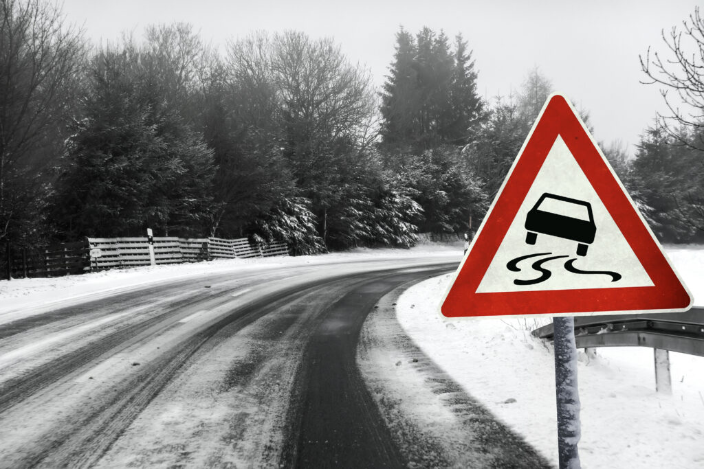
Understanding the Temperature Gap That Creates Dangerous Driving Conditions
Weather forecasts predict a low of 35°F overnight, a few degrees above freezing, so you assume roads will be safe. But the next morning, black ice coats bridges and overpasses, causing accidents despite the “above freezing” forecast. This dangerous disconnect happens because road surface temperatures often drop several degrees below air temperature—meaning icy conditions can develop even when your car’s thermometer reads 34°F or 36°F. Understanding why pavement freezes before air does can prevent accidents and keep you safe during marginal winter weather.
Air Temperature vs. Surface Temperature
The temperature reported in weather forecasts measures air temperature at a standardized height—typically 5 to 6 feet above the ground in a shaded, ventilated instrument shelter. This is the temperature meteorologists use for official records and forecasts.
But road surface temperature is often significantly different from air temperature. Pavement can be 5-10°F colder than the air above it under certain conditions, meaning roads can freeze when air temperature is still in the mid-to-upper 30s.
This temperature difference occurs because of how surfaces lose heat through radiation and how different materials hold and release thermal energy.
Radiational Cooling After Sunset
The primary reason road surfaces get colder than air is radiational cooling. After sunset, Earth’s surface—including roads—radiates heat energy outward toward space. On clear nights with calm winds, this heat loss continues throughout the night with nothing to replenish it.
Pavement radiates heat efficiently because it has high thermal emissivity—it readily releases the heat it stored during the day. As the road surface cools, it chills the thin layer of air directly in contact with it, but air is a poor conductor of heat. The bulk of the air several feet above the ground doesn’t cool as quickly because it’s not in direct contact with the cold surface.
This creates a temperature inversion—where air near the ground is colder than air a few feet up. Your car thermometer might read 36°F, but the pavement your tires are touching could be 30°F or colder.
On cloudy nights, clouds act like a blanket, absorbing some of the heat radiating from the surface and re-radiating it back down. This reduces radiational cooling and keeps surface temperatures closer to air temperature. That’s why overcast nights rarely produce unexpected icy roads when air temperatures stay above freezing.
Bridges and Overpasses Freeze First
Ever notice warning signs that say “Bridge Ices Before Road”? These aren’t placed randomly—bridges genuinely freeze before ground-level pavement.
Elevated roadways have cold air flowing beneath them as well as above. They lose heat from both top and bottom surfaces, with no insulating ground underneath to retain warmth. Ground-level roads benefit from residual heat in the earth below, which slows cooling. Bridges and overpasses lack this advantage.
The result is that bridges can be icy when ground-level roads are merely wet. Drivers crossing from clear pavement onto an icy bridge encounter sudden traction loss with no warning except the often-ignored signs.
Overpasses, elevated ramps, and any section of roadway with air circulation underneath face the same problem. Always reduce speed when approaching these structures during marginal temperature conditions.
Wind Increases the Temperature Gap
Wind affects the air temperature-to-road temperature relationship:
Calm conditions allow the coldest air to settle at ground level, creating maximum temperature difference between measurement height and road surface. This is when roads are most likely to freeze while air temperature stays above 32°F.
Wind mixes the air column, bringing slightly warmer air from above down to road level. This reduces the temperature gradient and makes air temperature a better indicator of surface temperature. However, wind also accelerates heat loss through convection, so the overall effect depends on wind speed and other factors.
Strong winds on clear nights can actually keep road surfaces warmer by preventing the coldest air from settling, but they also cool everything faster overall.
Time of Day Matters
Road surface temperature varies throughout the day:
Late afternoon and evening: Roads are often warmer than air temperature because pavement has been absorbing solar radiation all day. Dark asphalt can be 10-20°F warmer than the air on sunny afternoons.
Overnight: Roads cool rapidly through radiation, dropping below air temperature. The coldest road surface temperatures typically occur just before sunrise after a full night of radiational cooling.
Morning: As the sun rises, roads begin warming again, but shaded areas and north-facing slopes may remain icy even as air temperature rises well above freezing.
This daily cycle explains why morning commutes during marginal conditions are often more hazardous than evening commutes at the same air temperature.
Moisture and Dew Point
The presence of moisture dramatically affects when roads freeze:
Dry pavement must cool to 32°F or below before ice can form. Without moisture, temperature alone isn’t sufficient.
Damp or wet pavement from recent rain, melting snow, or high humidity freezes as soon as surface temperature drops to 32°F, creating immediate hazards.
Dew formation occurs when temperature drops to the dew point—the temperature at which air becomes saturated and moisture condenses. If the dew point is close to or below freezing and road surfaces cool to that temperature, frost or ice forms even without precipitation.
Fog in near-freezing conditions can deposit moisture on roads that immediately freezes, creating dangerous icy patches with no warning precipitation.
The “Wet Roads Freeze” Phenomenon
One of the most dangerous scenarios occurs when:
- Rain falls during the day or early evening when temperatures are above freezing
- Roads are thoroughly wet
- Precipitation ends and skies clear
- Temperatures drop overnight but stay above freezing at measurement height
- Road surfaces cool below freezing through radiation
- The water on the roads freezes into black ice
Weather forecasts might call for overnight lows of 34-36°F—technically above freezing—but don’t account for road surface temperatures dropping into the upper 20s. Drivers expecting merely cold, wet roads instead encounter ice.
What Temperature Should You Really Watch?
Instead of relying solely on air temperature forecasts, consider:
Pavement temperature forecasts when available. Some weather services and transportation departments provide road surface temperature predictions specifically for assessing ice risk.
The 36°F rule: Treat any forecast low of 36°F or below during wet conditions as potential icing conditions. This safety margin accounts for the typical air-to-surface temperature gap.
Dew point temperature: If the dew point is at or below freezing and roads are wet, icing is likely regardless of air temperature.
Recent precipitation: Wet roads combined with dropping temperatures create high ice risk even when air temperature stays marginally above freezing.
Other Factors That Influence Road Icing
Road composition: Dark asphalt absorbs and releases heat differently than concrete. Different materials have different freezing characteristics.
Traffic volume: Heavy traffic generates heat and friction that can keep roads above freezing even when untraveled roads ice over.
Sun exposure: South-facing slopes warm faster and stay warmer. North-facing or heavily shaded roads remain icy longer.
Salt treatment: Pre-treated roads resist icing to lower temperatures than untreated roads, though effectiveness decreases as temperature drops.
Elevation: Higher elevations are typically colder than valleys. Roads in hills or mountains ice over more readily.
Driving Strategy for Marginal Conditions
When air temperatures are within 5°F of freezing and roads are wet:
Assume ice may be present, especially on bridges, overpasses, and shaded areas.
Reduce speed to allow more reaction time if you encounter ice.
Increase following distance dramatically. You need much more space to stop on ice than on wet pavement.
Test brakes gently in safe locations to assess traction.
Watch other vehicles for signs of slipping or sliding that indicate icy conditions.
Don’t rely on thermometers alone. The reading on your car’s thermometer doesn’t tell you the actual pavement temperature.
The Bottom Line
A forecast low of 35°F doesn’t guarantee ice-free roads if conditions include recent precipitation, clear skies, calm winds, and overnight cooling. The several-degree gap between air temperature and road surface temperature means ice can form when forecasts seem to indicate safe conditions.
Understanding this disconnect helps you make better decisions about travel timing, route selection, and driving speed during marginal winter weather. That “above freezing” forecast provides less safety margin than many drivers realize—especially when wet roads and clear skies combine to create the perfect conditions for pavement to drop below freezing while the air stays just barely above it.
When temperatures hover near freezing and roads are wet, treat conditions as potentially icy regardless of what the thermometer says. The road surface temperature—not the air temperature—determines whether you’ll have traction or find yourself sliding helplessly across an icy bridge at 7 AM on a morning the forecast said would be “above freezing.”