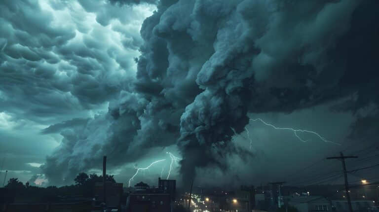
The Rare Weather Phenomenon That Combines Lightning and Blizzards
Most people associate thunderstorms with warm summer afternoons, not winter blizzards. But occasionally, winter storms produce lightning and thunder—a rare phenomenon called thundersnow. When it happens, it’s dramatic: brilliant flashes illuminating heavy snowfall, followed by rumbling thunder muffled by falling snow. Understanding what causes this unusual weather event reveals just how powerful winter storms can be.
Thundersnow Is Rare But Real
Thundersnow occurs in less than one percent of all snowstorms, making it an uncommon event most people never experience. When it does happen, it’s typically during the most intense winter storms—often nor’easters along the East Coast, lake-effect snow events near the Great Lakes, or powerful low-pressure systems with strong vertical development.
The rarity comes from the atmospheric conditions required. Thunder and lightning need the same ingredient whether it’s summer or winter: strong upward motion of air that creates charge separation within clouds. Winter storms typically lack the intense vertical development that summer thunderstorms have, which is why thundersnow is so unusual.
How Winter Storms Generate Lightning
Lightning forms when ice particles and water droplets within a cloud collide, transferring electrical charges. Lighter, positively-charged ice crystals rise to the top of the cloud while heavier, negatively-charged particles sink toward the bottom. When the charge difference becomes large enough, electricity discharges as lightning.
In winter, this process is much harder to achieve. Cold air doesn’t hold as much moisture as warm air, and winter storms typically have weaker updrafts than summer thunderstorms. But under the right conditions—usually when very cold air moves over relatively warmer surfaces like unfrozen lakes or ocean water—enough instability develops to drive strong updrafts and create thunderstorm conditions despite the cold temperatures.
The most common scenarios for thundersnow include strong low-pressure systems with intense lifting mechanisms, lake-effect snow with powerful convective towers, and areas where sharp temperature contrasts create extreme instability.
Lake-Effect Thundersnow
The most frequent thundersnow events occur during lake-effect snow around the Great Lakes. When extremely cold Arctic air moves over the relatively warm lake water, intense temperature contrasts create powerful convection—rising columns of air that can reach thunderstorm strength.
These lake-effect thundersnow events can produce dramatic snowfall rates of 3-5 inches per hour or more in very localized areas. Communities downwind of the lakes occasionally experience multiple lightning strikes and continuous thunder during heavy snow bands.
Meteorologists can sometimes predict lake-effect thundersnow when conditions show strong instability, but the exact timing and location remain difficult to forecast.
Characteristics That Make Thundersnow Different
Thundersnow differs from typical thunderstorms in several ways. The lightning tends to be less frequent—you might see one or two flashes during an entire storm rather than the nearly continuous lightning of summer severe weather.
Thunder sounds different during thundersnow. Snow dampens and muffles sound waves, so thunder travels much shorter distances—typically only 2-3 miles compared to 10-15 miles in summer storms. This means you usually only hear thunder if the lightning strike occurs relatively close to your location.
The lightning itself often appears brighter and more dramatic because it illuminates falling snow, creating an almost otherworldly glow. The contrast between the flash and the dark, heavy snowfall creates a striking visual effect.
Dangers of Thundersnow
While thundersnow is fascinating, it signals an extremely intense winter storm. When thundersnow occurs, snowfall rates typically spike dramatically—often reaching several inches per hour. Visibility drops to near zero, winds increase, and travel becomes extremely dangerous or impossible.
The lightning itself presents the same hazards as summer lightning. Anyone caught outside during thundersnow faces risk of lightning strikes, and the usual safety rules apply: seek shelter immediately, avoid open areas, stay away from trees and metal objects.
Because thundersnow is rare and unexpected, people are sometimes caught unprepared. The storm’s intensity can escalate quickly when thundersnow develops, creating whiteout conditions that strand drivers and make rescue difficult.
Where Thundersnow Happens Most
Certain regions experience thundersnow more frequently than others. The Great Lakes region, especially downwind of Lake Superior, Lake Michigan, and Lake Erie, sees the most frequent events due to lake-effect conditions.
The northeastern United States, particularly during powerful nor’easters, experiences occasional thundersnow when strong coastal storms develop. The mid-Atlantic coast and New England are hotspots during major winter storms.
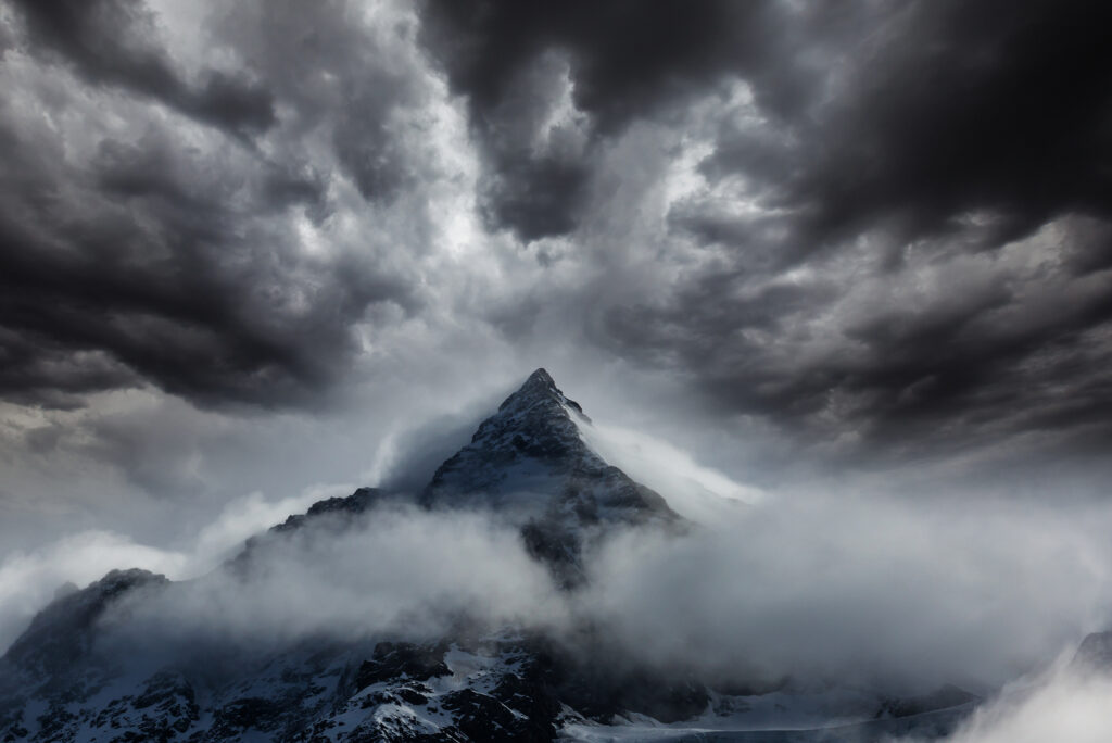
Mountain regions, where terrain forces air upward and creates instability, also see thundersnow occasionally. The Rockies, Sierra Nevada, and Appalachian Mountains can all produce conditions favorable for this phenomenon.
Internationally, thundersnow occurs in similar environments—areas with large bodies of water adjacent to cold landmasses, coastal regions experiencing intense winter storms, and mountainous terrain.
Forecasting Challenges
Predicting thundersnow remains difficult even with modern weather technology. Meteorologists can identify conditions that might support thundersnow—strong instability, adequate moisture, powerful lift mechanisms—but pinpointing exactly when and where lightning will occur is nearly impossible.
Radar can sometimes show thundersnow signatures, including intense reflectivity values and certain patterns that suggest convective activity. Weather satellites detect cloud-top temperatures and structures that indicate possible thundersnow development. But actual confirmation usually comes from eyewitness reports or lightning detection networks.
A Sign of Storm Intensity
If you ever experience thundersnow, recognize it as a warning that you’re in an exceptionally powerful winter storm. This is not the time to be traveling or outside. The combination of heavy snow, low visibility, strong winds, and lightning creates some of the most dangerous winter weather conditions possible.
The storm producing thundersnow is likely generating very heavy snowfall that will accumulate rapidly. Road conditions deteriorate quickly, and getting stranded becomes a real possibility.
An Unforgettable Experience
Despite the dangers, people who’ve witnessed thundersnow often describe it as one of the most memorable weather events they’ve ever experienced. The unexpected combination of lightning illuminating heavy snow creates an almost surreal atmosphere. The muffled thunder rolling through falling snow sounds unlike anything else in nature.
Meteorologists and weather enthusiasts get excited when thundersnow occurs because it represents such a rare intersection of conditions. It’s a reminder that even common weather phenomena like snowstorms can produce extraordinary variations when atmospheric conditions align just right.
Respect the Rarity and the Risk
Thundersnow represents winter weather at its most intense. If you hear thunder or see lightning during a snowstorm, take it as a clear signal to get inside and stay there until conditions improve. This rare phenomenon is fascinating from a safe location, but it’s also a powerful reminder that winter storms deserve the same respect and caution as severe summer weather.